Reynolds River 4WD Track: Litchfield Park

Tjaynera (Sandy Creek) Falls
Reynolds River 4WD Track: Litchfield Park
Just a couple of hours from Darwin this track provides for a great dry season day trip with 4X4 adventure and swimming in waterholes under spectacular waterfalls.
Reynolds River Track is 44km long and provides the opportunity to visit Blyth Homestead, Tjaynera Falls (Sandy Creek Falls), and Surprise Creek Falls. What is it like as a 4x4 track? I have seen comments in the media on this track that range from:
· “But we all know that the Litchfield park idea of a 4x4 track is a dirt road with some puddles of water.”
· To – “A GROUP of English tourists walked for 10km in the tropical afternoon heat along a Litchfield National Park 4WD drive track after their car became bogged in a river crossing. The tourists had attempted to drive through the Reynolds River Crossing late yesterday afternoon”


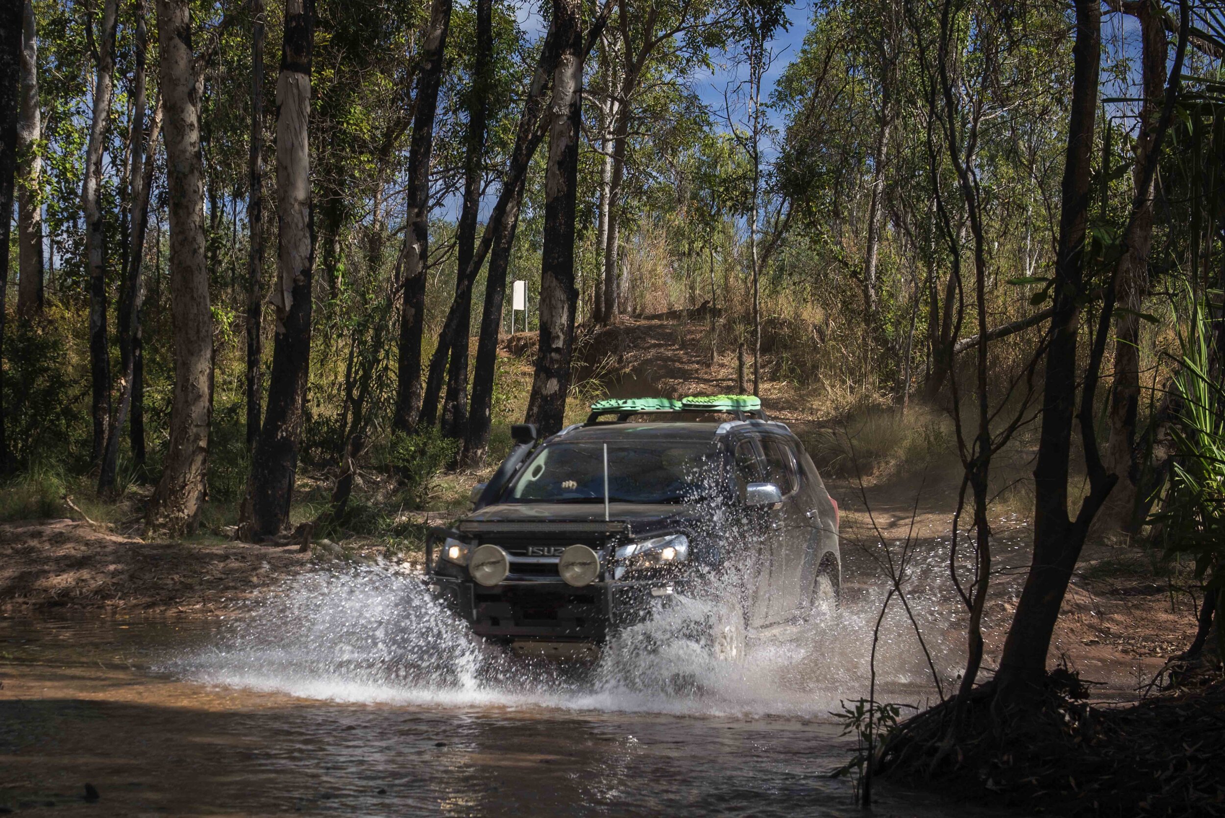
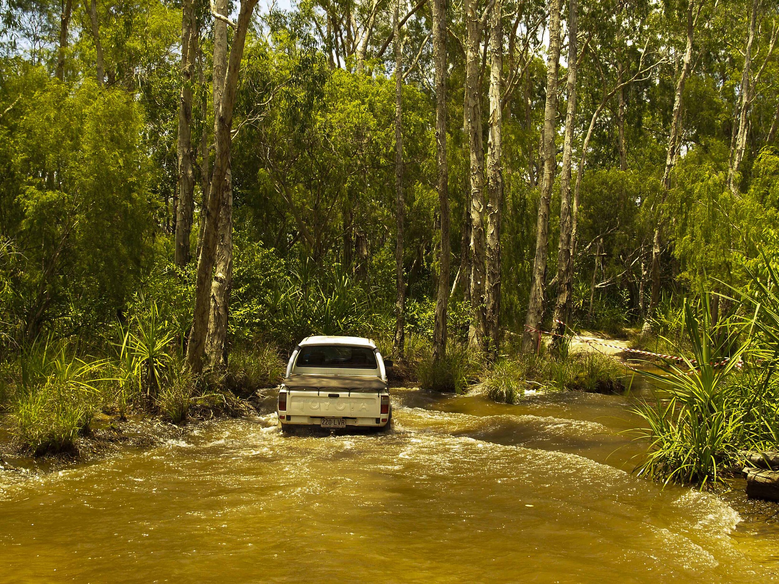
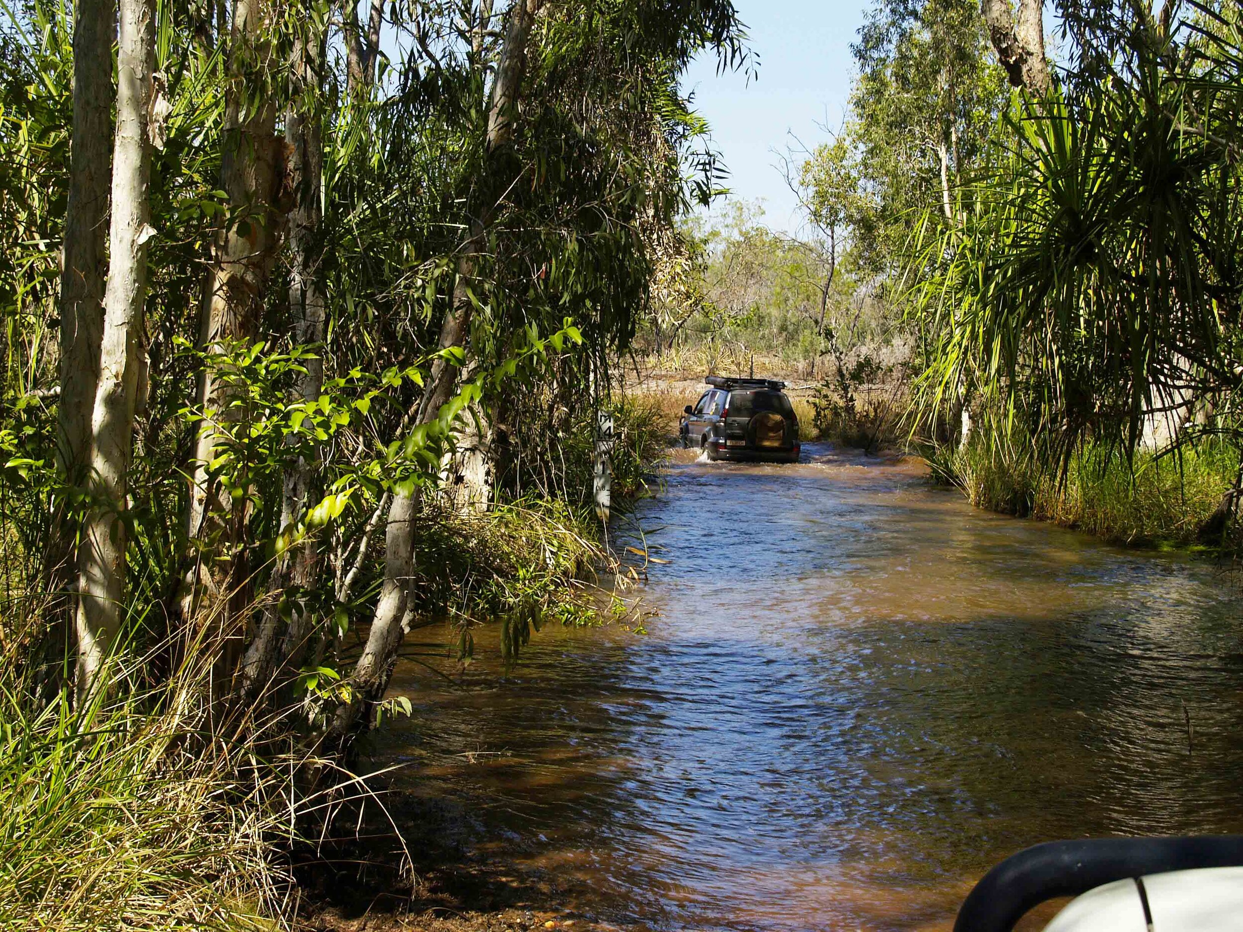
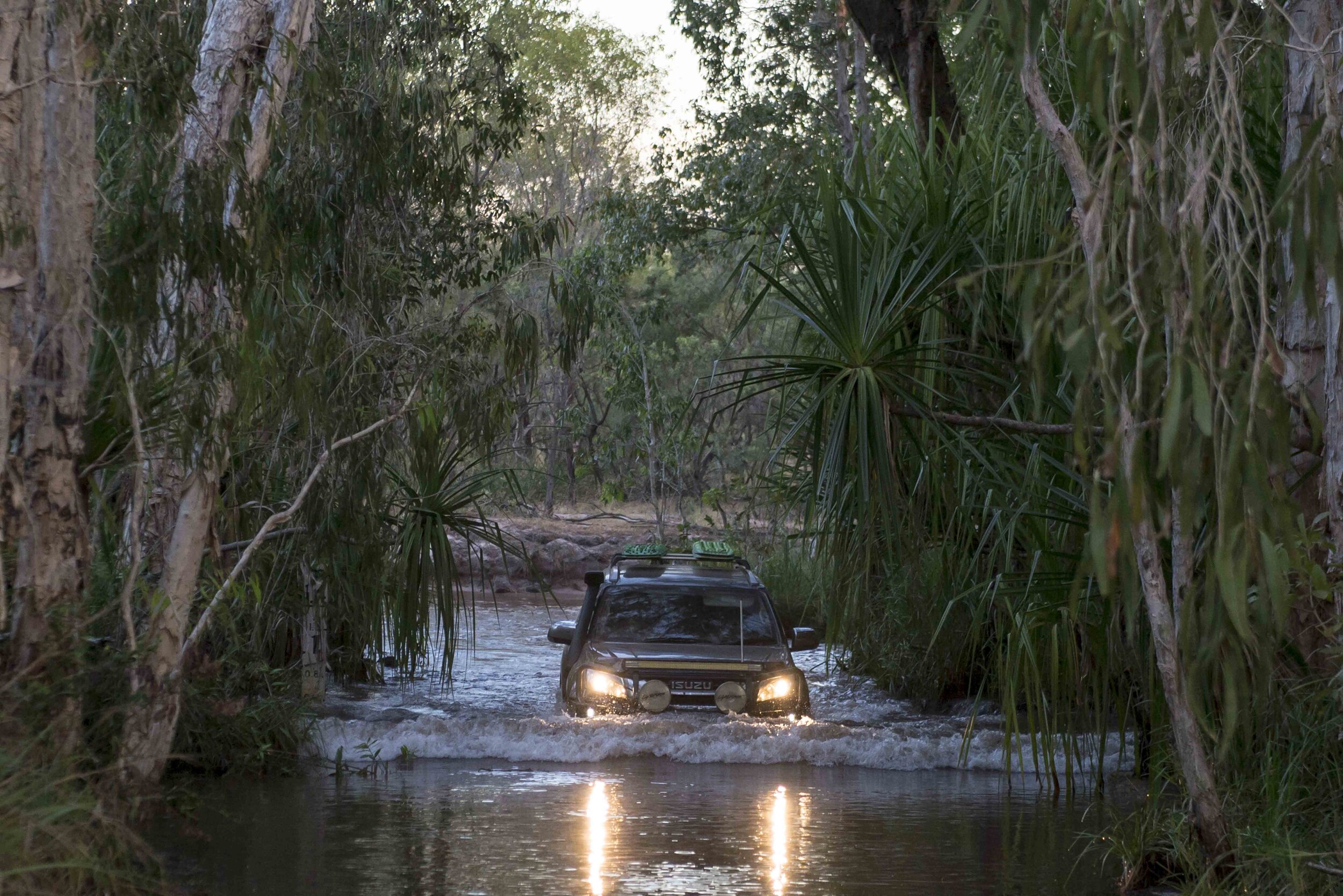
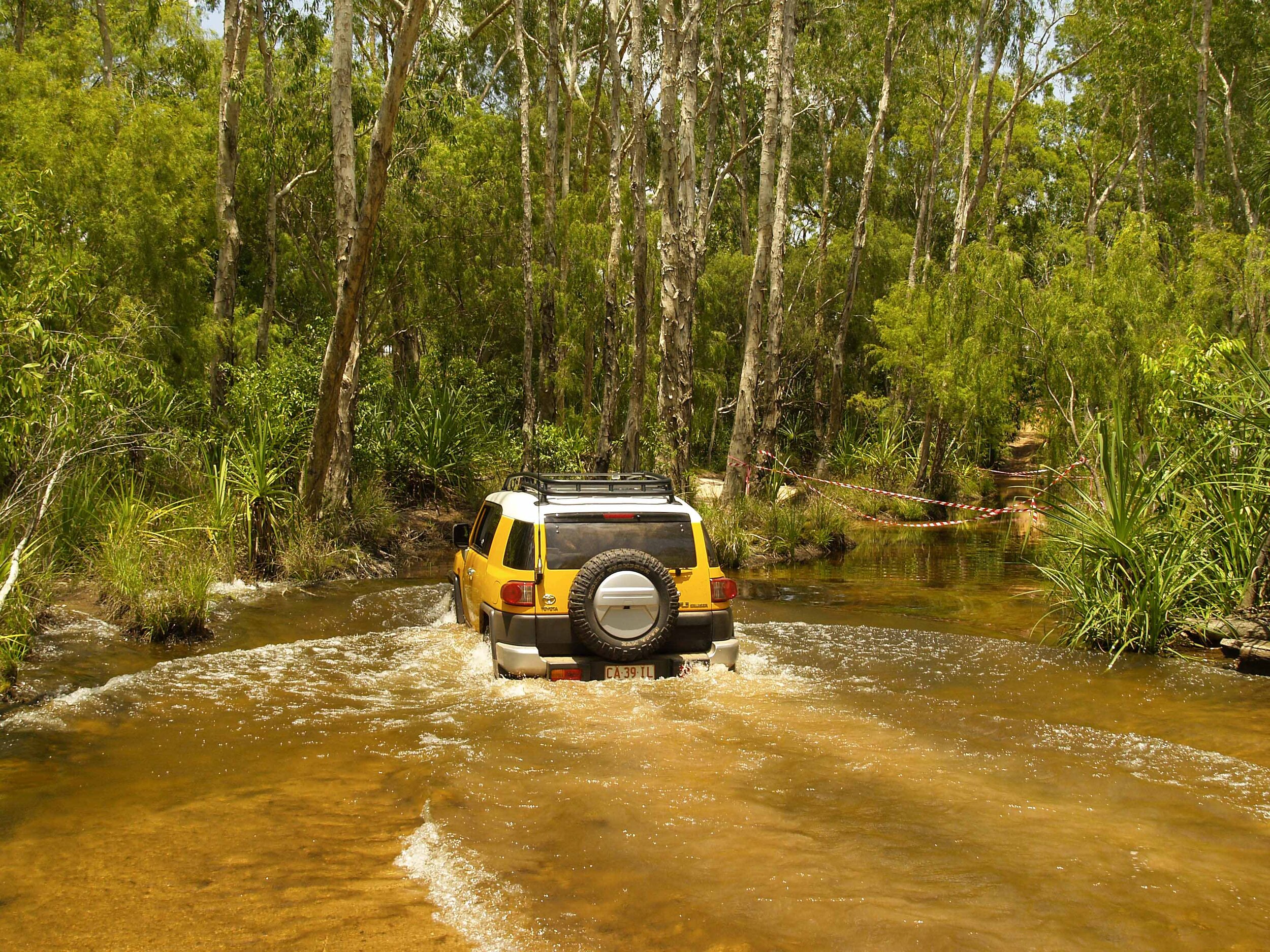
The track has no hill climbs or rocky terrain, but it does have several river crossings, that may cause problems if you try to negotiate the track too early in the Dry Season. It is for this reason, the park authorities advocate the use of a 4WD that is equipped with a snorkel when attempting this track.
Early in the Dry expect high water levels, up to the bonnet (hood) of an average 4WD vehicle. Water levels however drop rapidly in the Dry, and in the latter part of the Dry, you can expect water levels to be low, just to reach up to the running boards of your vehicle. Most of the rivers in the late Dry will have dried up, leaving dusty, but firm, riverbeds. Although the drop into, and climb out of, the riverbeds can be steep, and the banks can be eroded at times, they are usually negotiated relatively easily. The beds of the creeks are all firm and compacted, so getting bogged while in the water is unlikely if you stick to the correct track. I assume the parks board gravels these riverbeds to keep them firm and maintain the crossings.


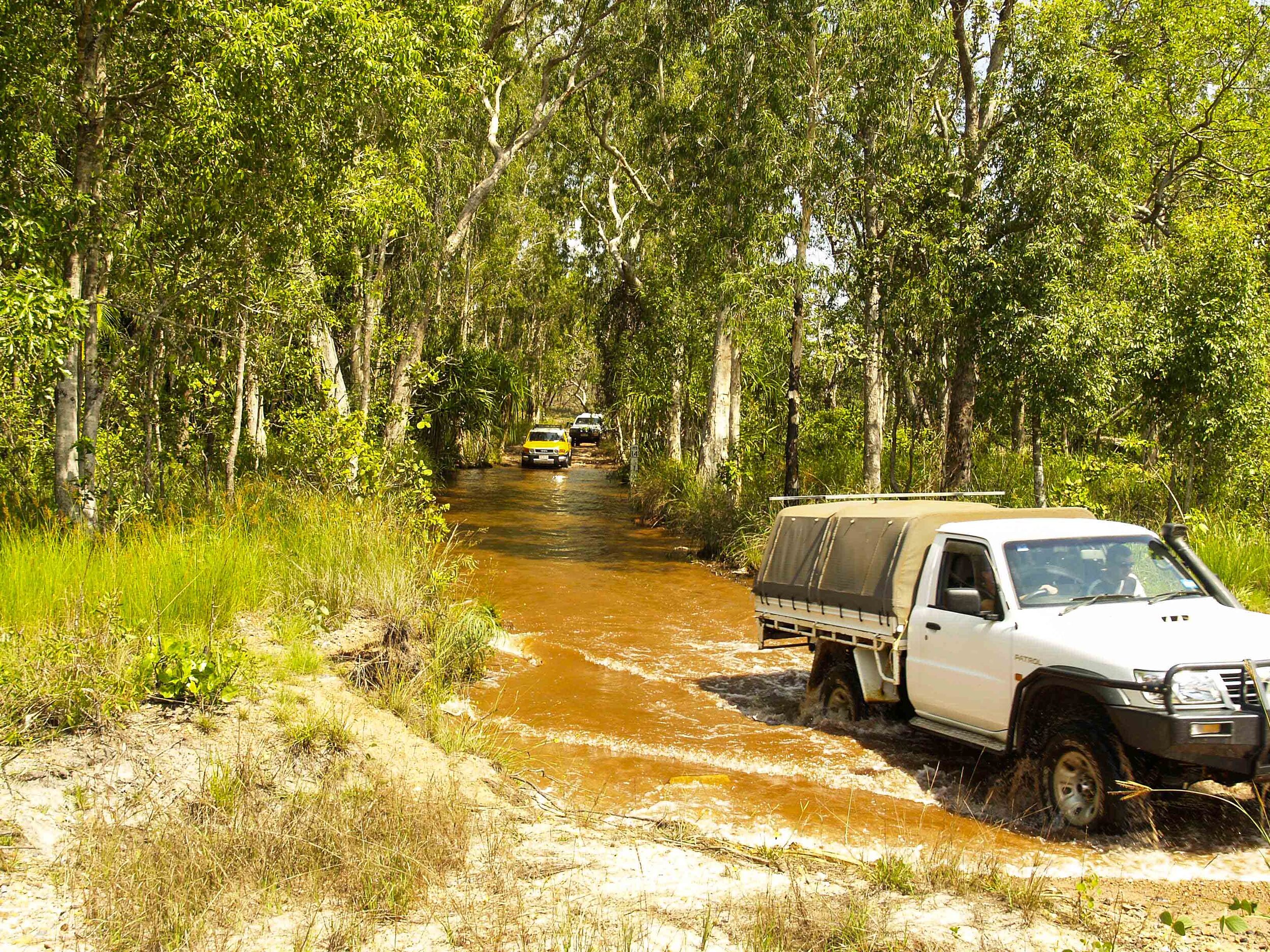
All 4x4 training advises you to walk any river crossing before attempting to cross in your vehicle. Is this advisable in the NT? This is the advice from the NT government Be Crocwise:
“You should always be aware of the risk of a saltwater crocodile attack in all Top End waterways.”
The next question that arises is: What if you don’t walk the river and then get bogged? A lot of time is then spent in the water during recovery. My opinion, on the Reynolds River Track, is that it is well maintained by the park authorities and the riverbed should hold no unpleasant surprises as such.
I do not walk the crossings – I have a healthy respect for salt-water crocodiles.

Getting There
Reynolds River Track is a four-wheel-drive track located in the southern section of Litchfield National Park. The park itself is located about 120km south of Darwin and is accessible via Batchelor on a sealed road. The Litchfield Park Road that runs through the park, a sealed, and provides access to most of the attractions and waterfalls within the park. The turn-off to Reynolds River is located between the popular Tolmer and Wangi Falls.
Overview of the Track
I would grade this track as Difficult in the early Dry due to the water hazards, and medium in the late Dry. (Victoria Public Land 4WD Tracks Classification).
The track does have some sandy sections but is mostly firm.
It can become heavily corrugated in sections especially in the late Dry.
Large and at times very steep humps have been built across the track for its entire length to facilitate drainage. These could damage your beers if negotiated at pace!
Can be a narrow track with some blind bends. Take care, take it slow and watch for oncoming traffic.
Great way to access less crowded waterfalls in the Park.
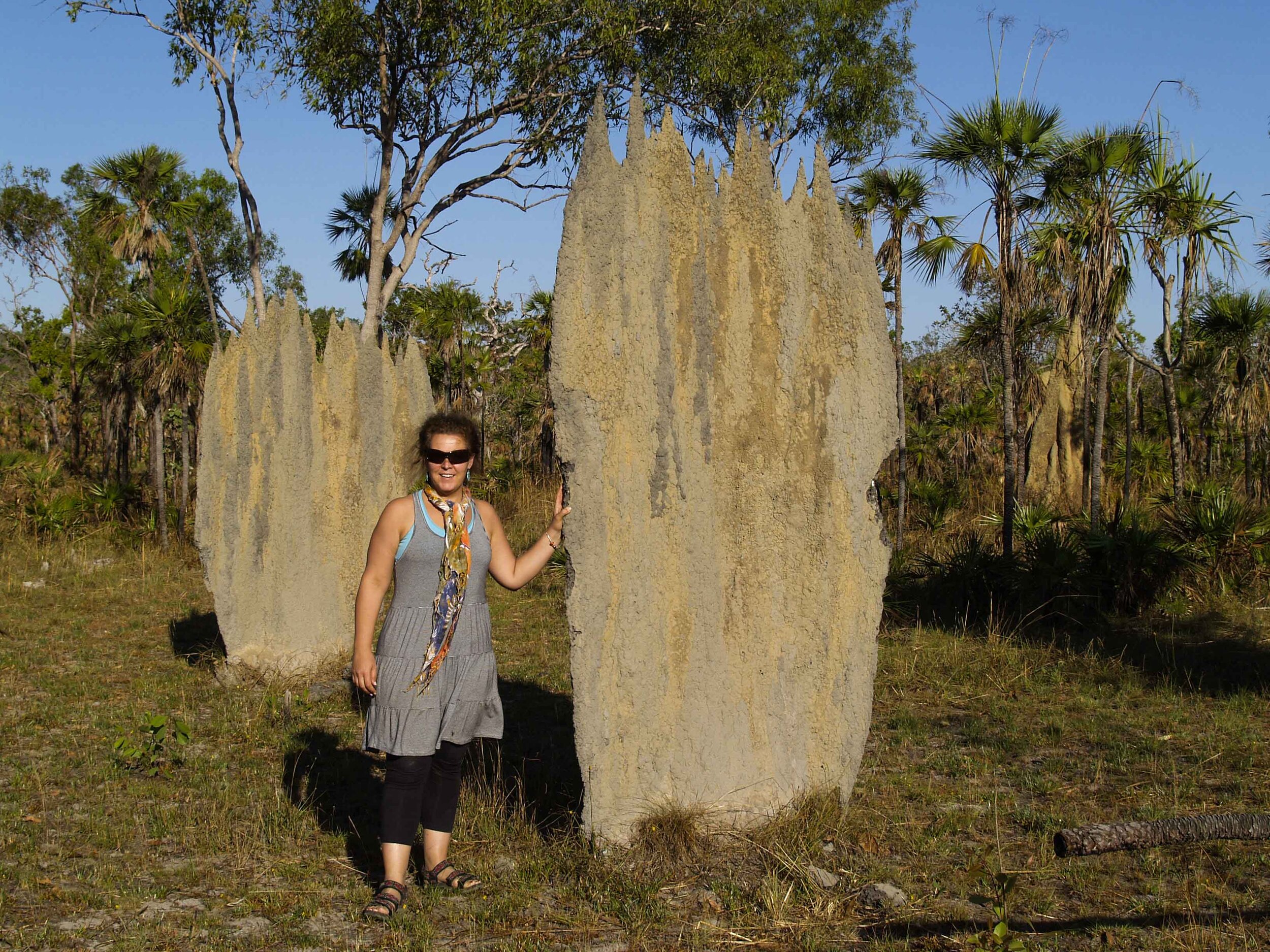
Great way to get onto the floodplains and experience both the cathedral and iconic magnetic termite mounds close up.


This tack is closed during the Wet Season and is only open to the public during the Dry Season. Check that the track is open before you head-out. Contact the Road Information Services on - 1800 246 199 or
What to Explore on this Track
Blyth Homestead
Tjaynera (Sandy Creek) Falls
Surprise Creek
Blyth Homestead
Getting There
After travelling south for about 5.4 km along the Reynolds track take a quick detour and check out this site. After turning left onto this sidetrack you find a small river crossing about 20m long with a firm boulder-strewn base on this section of road. Blyth Homestead and the adjacent tin mine will take less than half an hour to visit.

Blyth Homestead
An outstation built in 1928
Some information on Blyth Homestead is sourced from Wiki.
“In 1924 a small homestead was built by the Sargent family on their leased land in the lowlands near Tolmer Falls where there was reliable water and reasonable grazing for their cattle. Their farm proved successful and in 1928 they built Blyth Homestead as an outstation a little further south, so their cattle could take advantage of the good grazing among the paperbarks in this area. Typical of other structures of that time, the homestead is supported with cypress pine tied together with heavy wire and covered with corrugated iron. The family was able to farm their vegetable and fruit crops, and held up to 13,500 head of cattle, due to the permanent water nearby. After 40 years, the Sargent family sold the lease to the Townsend family who farmed until the early 1960s. The abandoned homestead stands as a stark reminder of the tough conditions graziers faced.”
https://en.wikipedia.org/wiki/Litchfield_National_Park
Tjaynera (Sandy Creek) Falls
Getting There
The next stop traveling in a southerly direction on the Reynolds River Track (about 7km down the track) is the turn-off to Tjaynera (Sandy Creek). A further 2km drive will get you to a small campground and car park for the walk to the falls.
The campsite has about fifteen sites that are divided into designated bays, separated from each other by a strip of open woodland. Each campsite has its designated fire pit that can be used for open fires providing no fire bans are in place. Besides, the campsite boasts a single block with showers and toilets. Camp fees apply and an honesty box is located at the camp entrance requesting payment before setting up your camp. This means that you cannot book ahead, and camping is on a ‘first come first camp’ basis. There are no powered sites, and no generators are allowed.
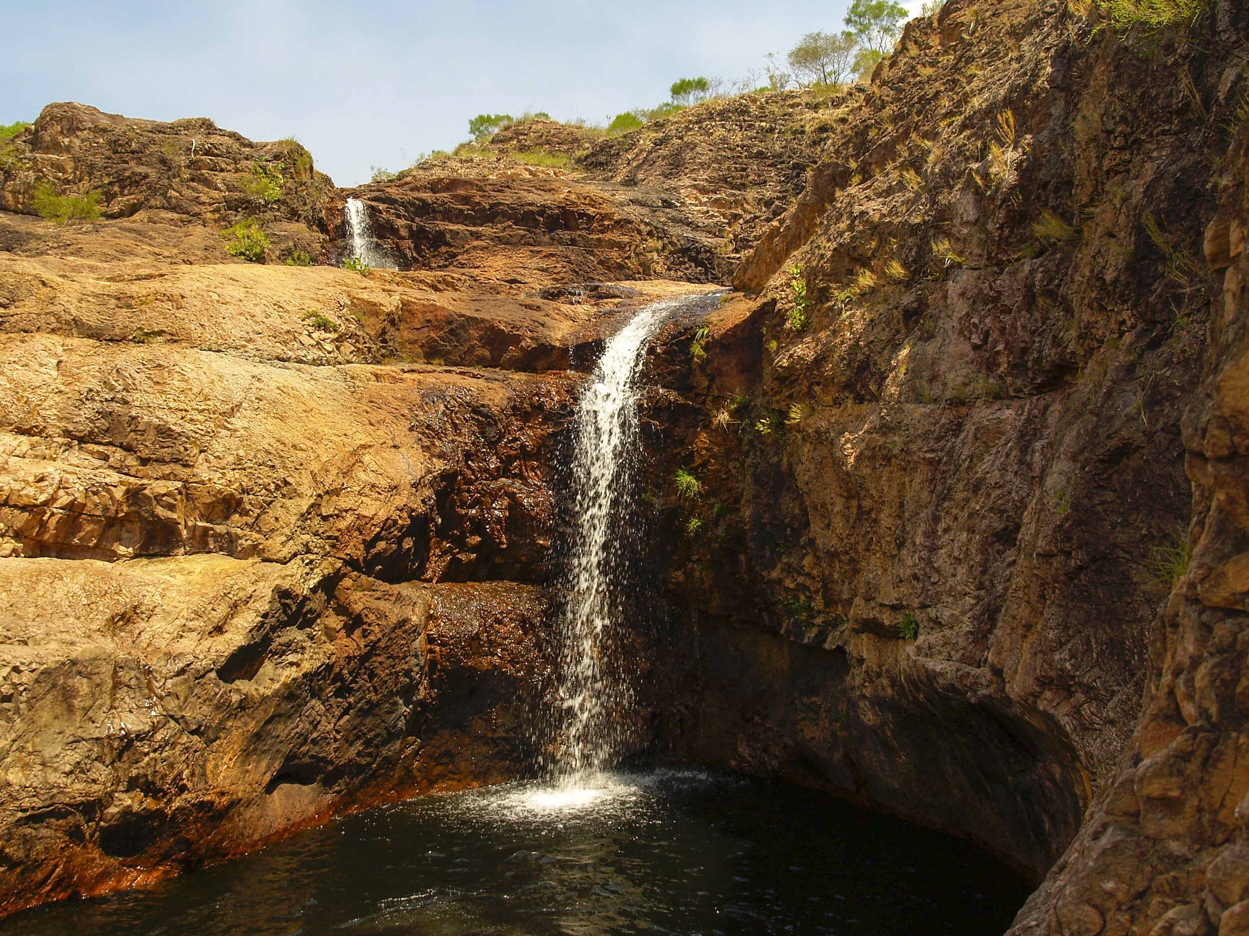
These falls are breathtaking and are my favourite in Litchfield Park.
The car park, located at the campsite, marks the start of the walk to Sandy Creek Falls. The walk is about 1.7 km to the falls and is graded as “3 moderate” with the recommended time for walking to the falls and back at about 1.5 hours. The path follows the creek bed with small detours up the hillside where the creek bed is not accessible.
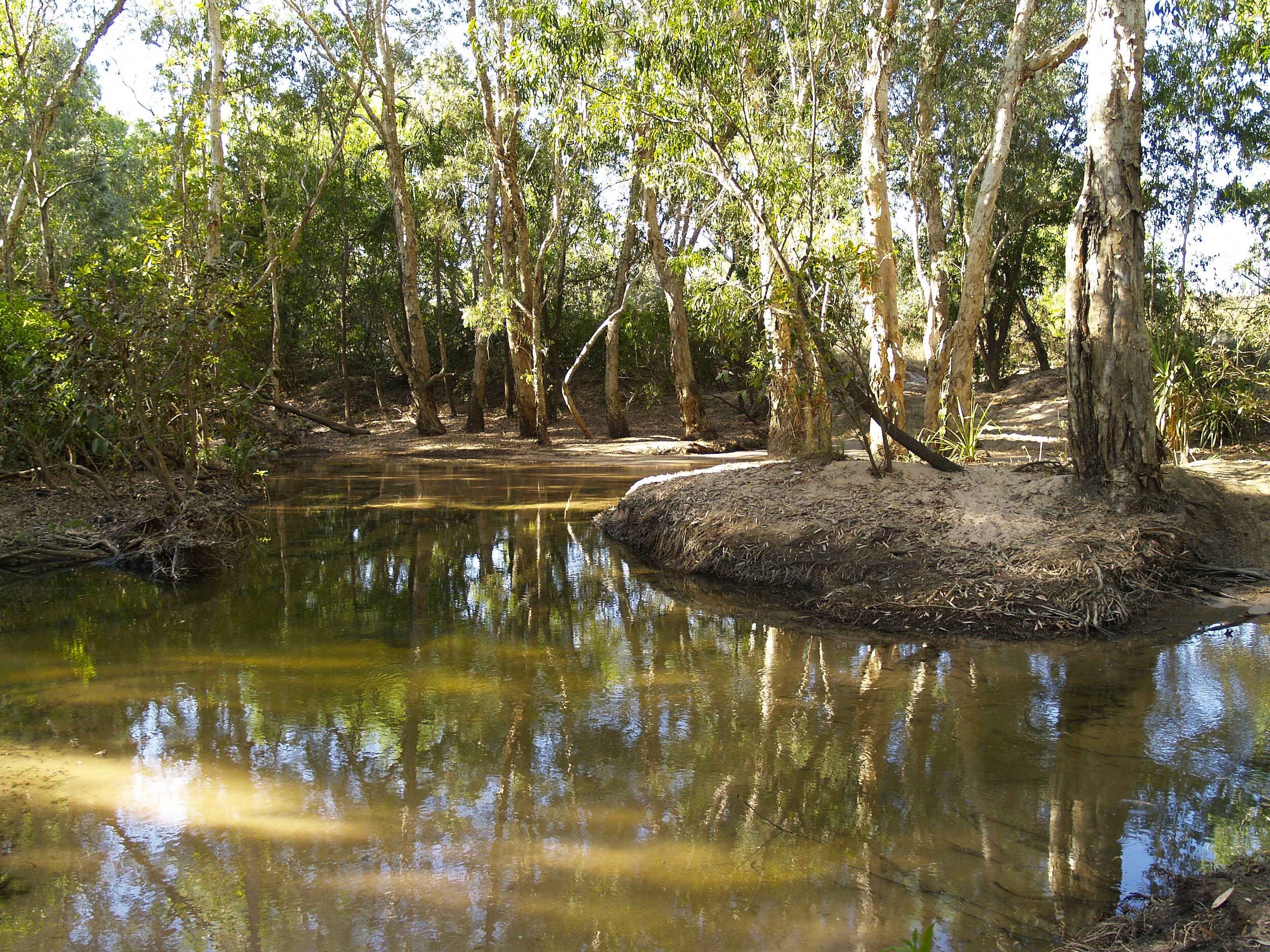
The walk ends at Tjaynera Falls, a tiered waterfall of about 40m that plunges into a large (100m) pool with cool, clear water, containing large fish that can be seen exploring its edges. Towering red-brown cliffs on the eastern side surround the pool while the northern cliffs remain moist with green ferns clinging to the ledges. This pool is great for swimming, and signs suggest that there is a very low risk of crocodiles. Due to the four-wheel-drive access and the long walk to this waterfall and swimming hole, it is often less crowded than the other swimming holes in Litchfield Park. The waterfall is known to flow throughout the Dry, and together with the swimming hole, is well worth visiting.
Surprise Creek
Getting There
The next stop traveling in a southerly direction on the Reynolds River Track after the turn-off to Tjaynera (Sandy Creek) is Surprise Creek. A further 20km drive will get you to the turn-off to Surprise Creek.
Surprise Creek has a small area designated for camping with only basic toilet facilities. No drinking water is available. Note: Litchfield Park has no rubbish bins in the park and all rubbish needs to be removed by visitors.
Surprise Creek
There are two wonderful cauldron-shaped swimming holes to enjoy.
From the car park a relaxing, short walk (300m) over flat ground reveals Surprise Creek swimming hole. Hewn out of the solid rock that forms the side of this hill are two perfect round cauldron-shaped swimming holes. Water flows down the hill and then from one cauldron to the next. They are deep (about 6m) with sheer cliff walls around each hole and a small waterfall feeding into each cauldron. This is one of the more remote swimming holes in the park and you will often have this spot all to yourself.
The Track
Traveling this track from north to south. Turn off the bitumen Litchfield Park Road onto Reynolds River Road. Signboards are posted at both ends of the track showing distances and what is open and closed on the track. Within 600m you encounter the first river crossing. This crossing does not have steep banks and does have a firm boulder-strewn base. It can be a meter, or more, deep early in the Dry season. Next, you find a small creek crossing 1.75km from the start of the track. This section of the track sees a lot of traffic and becomes corrugated very early in the season. The large mounds that facilitate water drainage are already evident and need to be taken slowly.
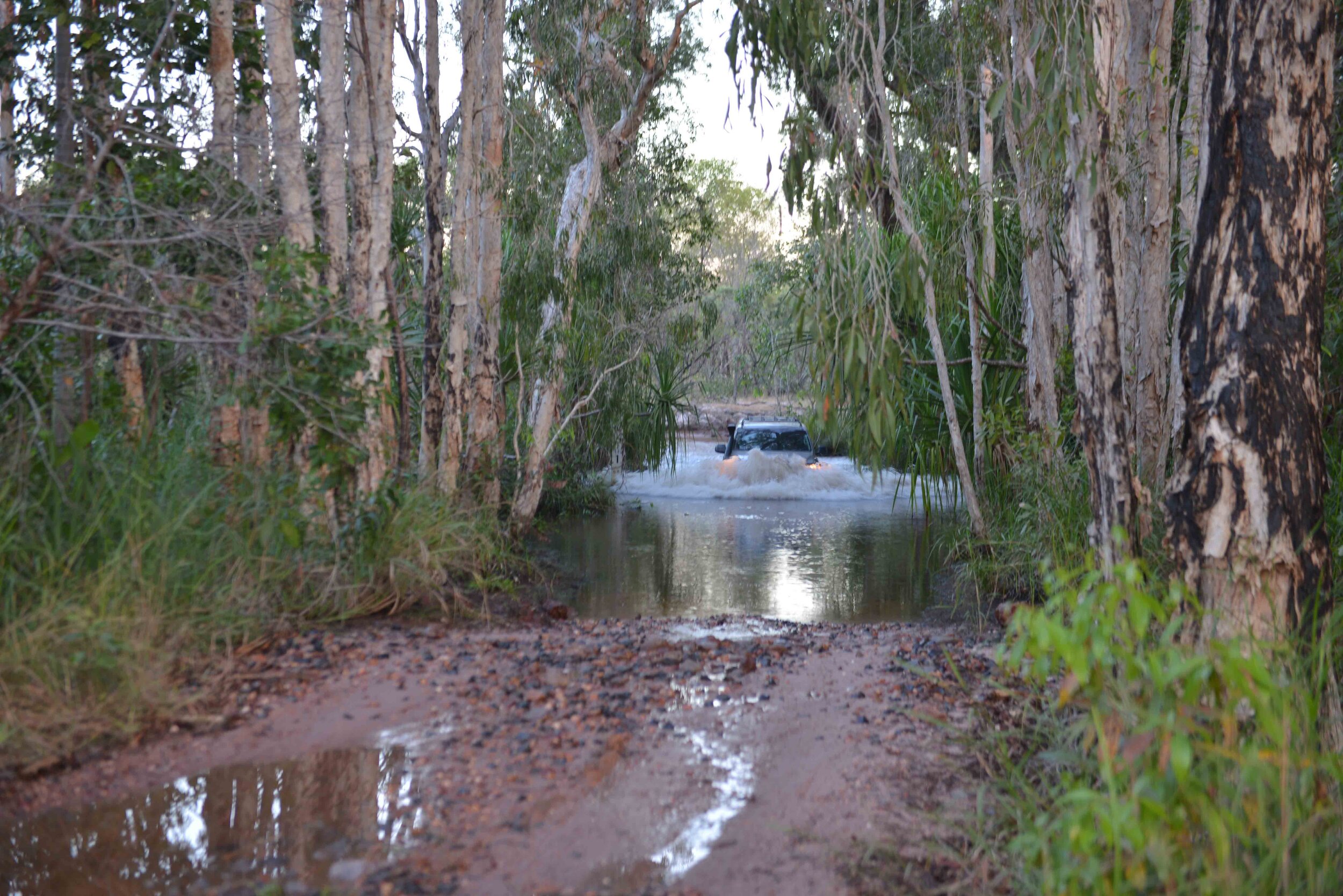
Travelling south on the Reynolds River Track after the turn-off to Sandy Creek Falls the next large river crossing is 1.75km down the track. This is the East Reynolds River Crossing. This river can be deep in the early Dry, up to the bonnet of most standard four-wheel drives. Drive down a bank of about 5m into the riverbed. After travelling along the riverbed, you then transverse over a small sand island, before finally returning to the riverbed and then up the riverbank. Two tracks are found in this short section of the river crossing, the first described above takes you over a small island, the second is described below. The section of road in the riverbed to the right of the sandy island (travelling south) can be deep, and I have found it taped-off on several occasions. I presume that park authorities are trying to limit traffic here.
The track then continues south over large floodplains with vast numbers of magnetic termite mounds with the occasional cathedral termite mound. The track remains firm but does have sections with shallow bulldust. The next crossing, 6km south of the Sandy Creek Falls turn-off, is the Reynolds River crossing. Again, there is a steep drop of about 5m, this time to a straight crossing over a small, boulder-strewn riverbed and out the opposite bank. The track then continues over Mistake creek and then the track takes you over more savannah woodland with flood plains and termite mounds.
Eighteen kilometres after the Sandy Creek Falls turn-off is a small creek 2 to 3m wide, with a drop of about 2m. The short section of track between the above river crossing and Surprise Creek turn-off has some fairly soft sandy sections. A few kilometres later and you are at the turn-off to Surprise Creek. After Surprise Creek, you travel almost parallel to the Reynolds River with one final river crossing 5km south of the turn-off to Surprise Creek. The approach to the river is a gradual slope downhill with some sandy sections just before crossing onto a firm rock-strewn riverbed. The southern exit from the riverbed is a lot steeper than the entrance. The track then continues through savannah woodland for 44km before joining the Daly River Road.