Jatbula Hiking Trail: Katherine
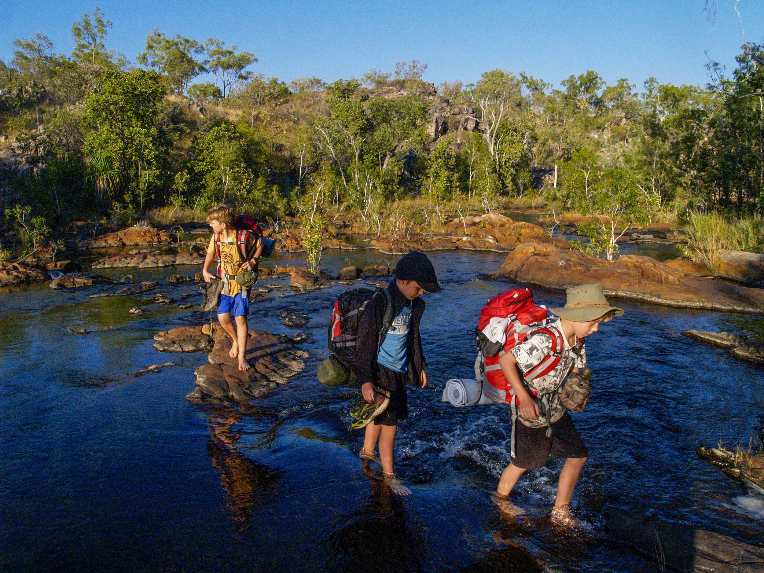
River crossing to get day three of the hike underway from Crystal Falls
Jatbula Trail
This is an exceptional hike. It provides a moderate challenge that is however difficult enough to leave you with a sense of accomplishment. The three to four hours of hiking per day provide the opportunity to experience the riverine forest, monsoon rainforest, open forest, woodlands, and plateau scrub. This is all randomly interspersed with aboriginal rock art, stunning vistas from the edge of the Arnhem Land Escarpment, and occasional swimming holes. It all makes for an interesting journey and the opportunity to stop and enjoy the surroundings.
The short distances each day mean that you have a lot of time to enjoy each campsite. The highlight of this hike has to be the overnight campsites. Whether by design or by sheer luck each campsite is truly unique. You may imagine that each site is just a camp area next to the same sort of river as the previous camp. Nothing could be further from the truth. Get out on the trail and take the time to experience and explore the unique environment that each site is situated in. It is well worth the time and effort.
Overview of Jatbula Trail
The Jatbula Trail is located in Nitmiluk National Park (Katherine Gorge National park) just outside Katherine, Northern Territory. The trail is one of the more popular lengthy hikes in Australia. This coupled with a firm restriction on the number of hikers and the fact that it is only open in the dry season (winter months) makes booking in advance essential. Hiking is done over six days, five nights, and covers roughly 62km from Katherine Gorge to Edith Falls. Each day’s walk takes about 3 to 4 hours of comfortable walking. Getting to the campsites just after midday leaves a lot of time to go for a swim, explore the area, and relax.
The trail was named after Peter Jatbula a traditional owner of the land and a member of the Jawoyn people. This trail follows the traditional route (used by the Jawoyn) along the western edge of the Arnhem Land Escarpment. Rock art at various sites along the trail bears testimony to the long heritage of this walking trail. Good facilities at the start and end of the trail, a well-marked trail, basic toilets at each campsite, and a pristine environment are a testimony to the Jawoyn people and the Wildlife Commission working well together.
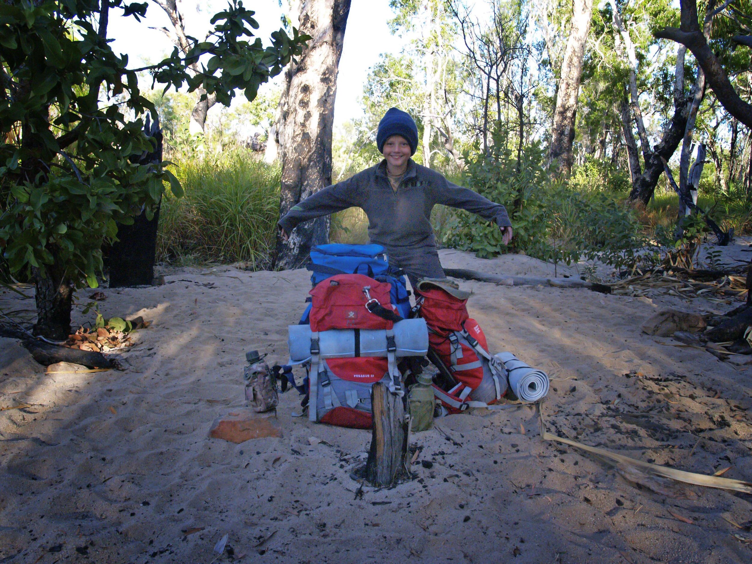
Bookings are made through Nitmiluk Tours who operate the accommodation, gorge cruises, canoeing trips, and helicopter flights at the gorge. We spent the night in the permanent tented accommodation.


Day 1: Jatbula Trail
After breakfast, we caught the charter boat that takes guests up the gorge. They provide a ferry service across the Katherine River. The first day of our hike was to take us from the Katherine River to Biddlecombe Cascades a distance of 8.3km. The walk follows a path between the foot of the escarpment and runs parallel to 17 Mile Creek. After about an hour of walking (3.8 km) Northern Rockhole and waterfall provide a great spot for a break and a swim. No water was flowing over the falls on our hike (mid-July) the pool was stagnant but the water looked fairly clean and inviting. We all took a dip, had a bite to eat, and then moved on. The path then takes a slow climb of about 100m over the next 4.5 km as you ascend the escarpment. This is a fairly easy walk with the only disappointment being that you follow a car track for a large section. After one and a half to two hours of walking Biddlecombe Cascades provides the perfect spot to stop and relax.
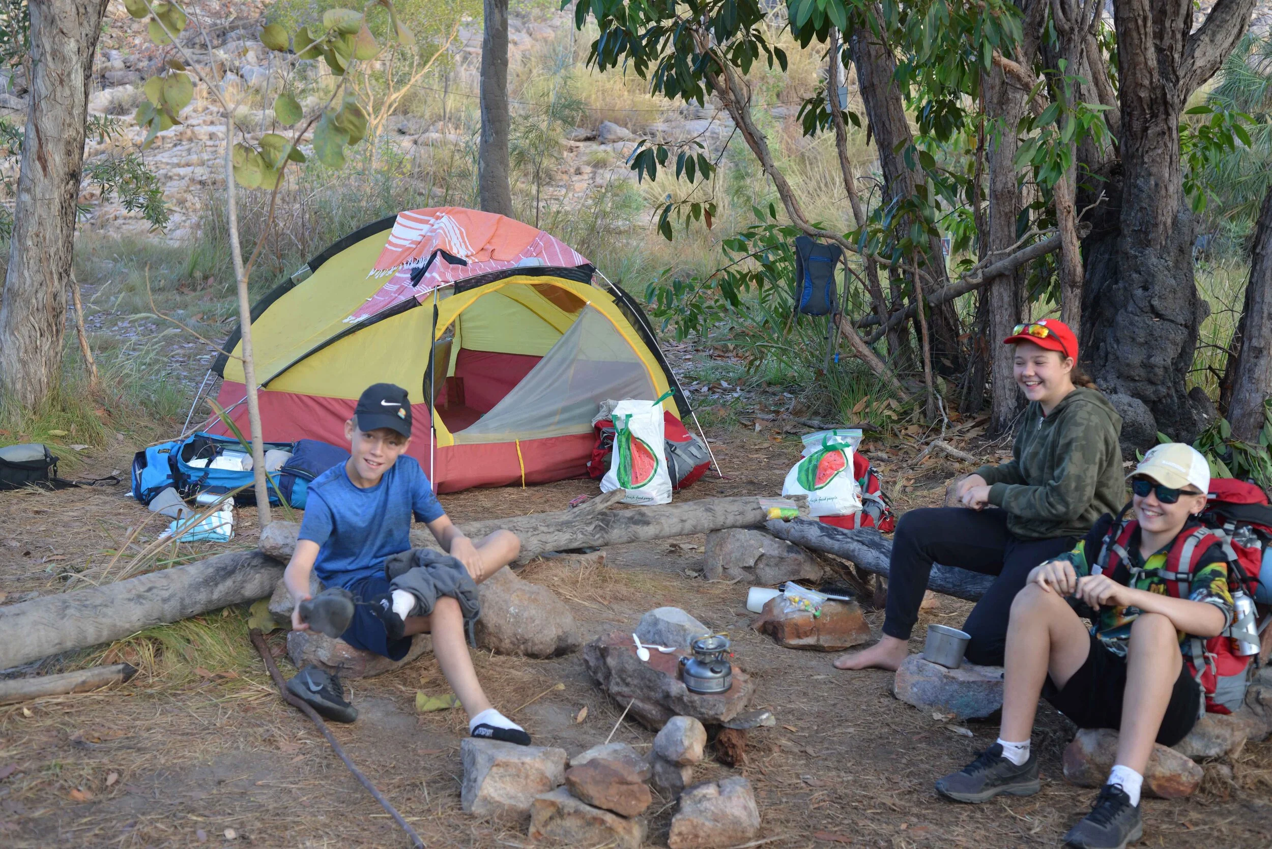
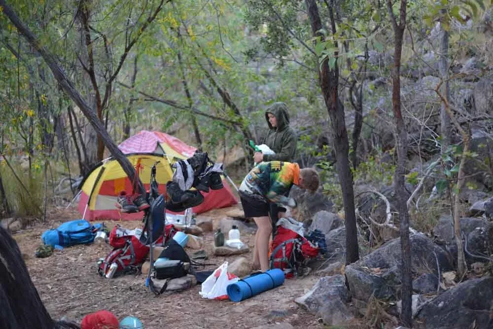
Biddlecombe Cascades is about as stunning as they come. Two streams of clear water come together above the cascades to ensure a strong flow of water over the cascade and into a deep pool at its base. From the base of the cascades, the water flows over a waterfall (+/_ 5 to 10 meters high) and down the edge of the escarpment. The afternoon was spent relaxing in the pools. As evening approached the mozzie domes, sleeping gear, and camp stoves came out. Water was collected from the stream and our food was rehydrated and served. No fires are allowed on the trail and all cooking has to be done on stoves. After dinner, most of us were ready for bed.


Day 2: Jatbula Trail
A fine choir of bird songs announced morning. Our second day was to take us from Biddlecombe to Crystal Falls (11 km)along a well-marked trail. The trail undulates over some rocky dry riverbed terrain, grassy plains, and occasional riverine forest. On the way, you get your first rock wall adorned with aboriginal art and some great panoramas from the top of the escarpment. Again an easy four hours of walking will see you arriving at crystal falls.
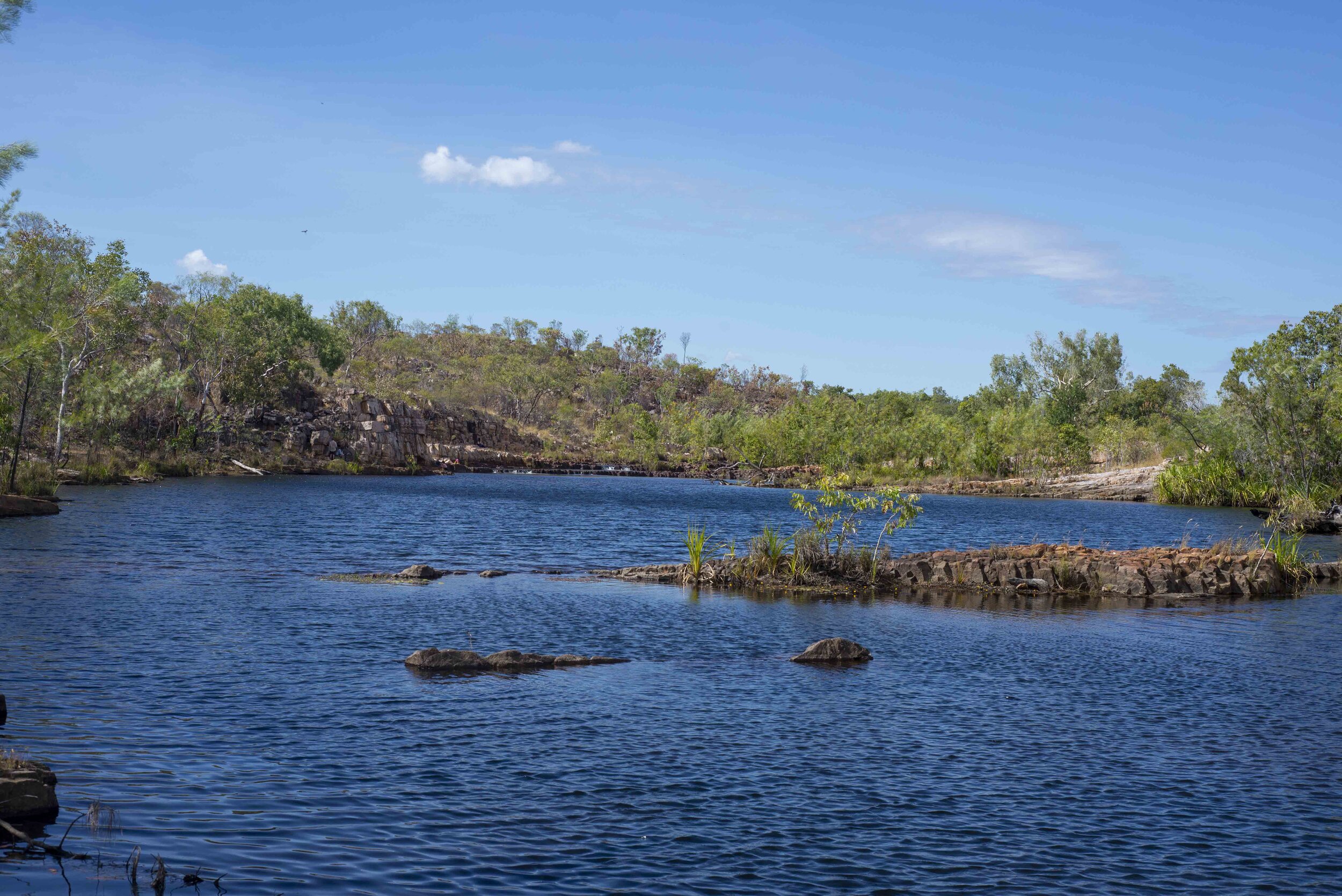
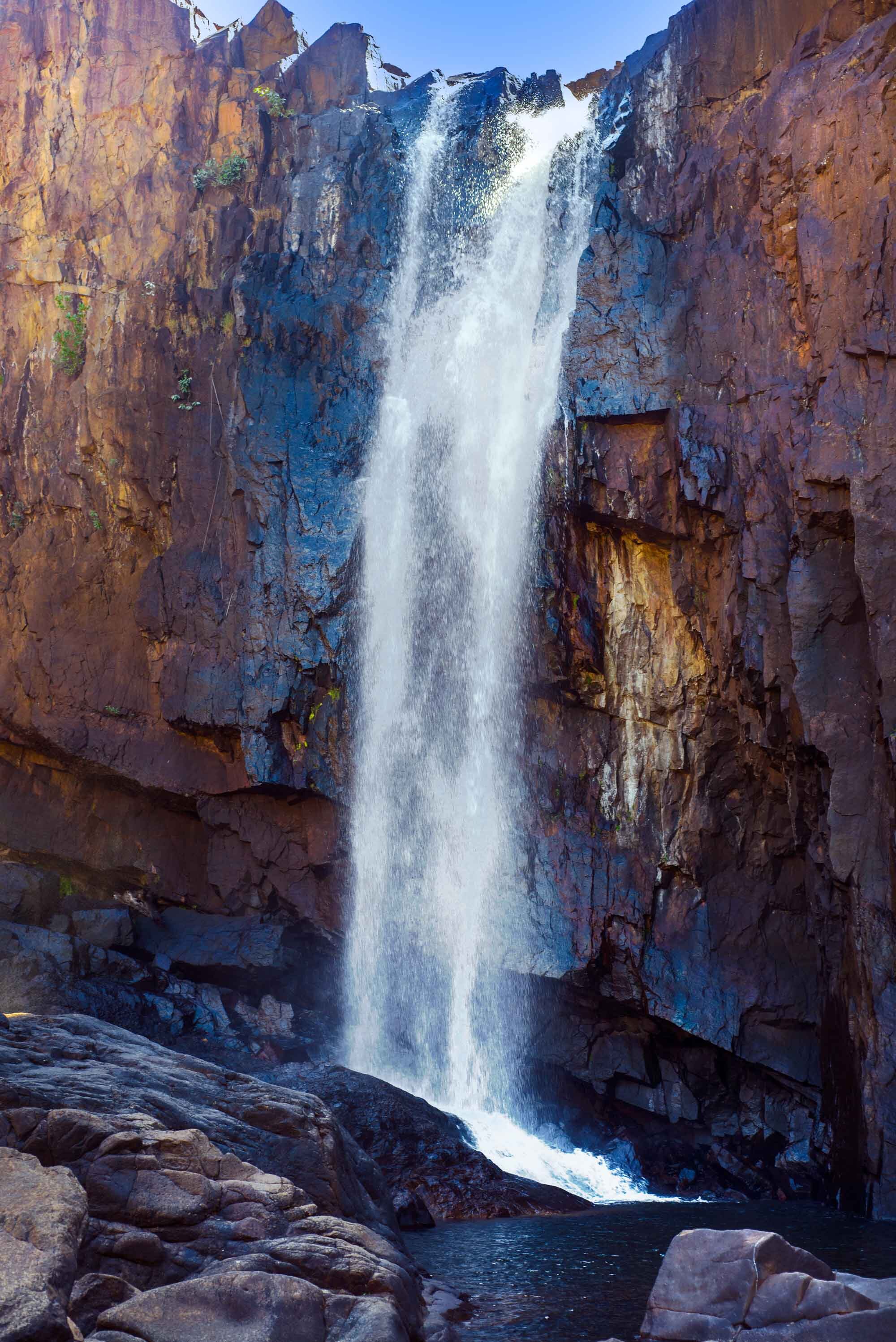
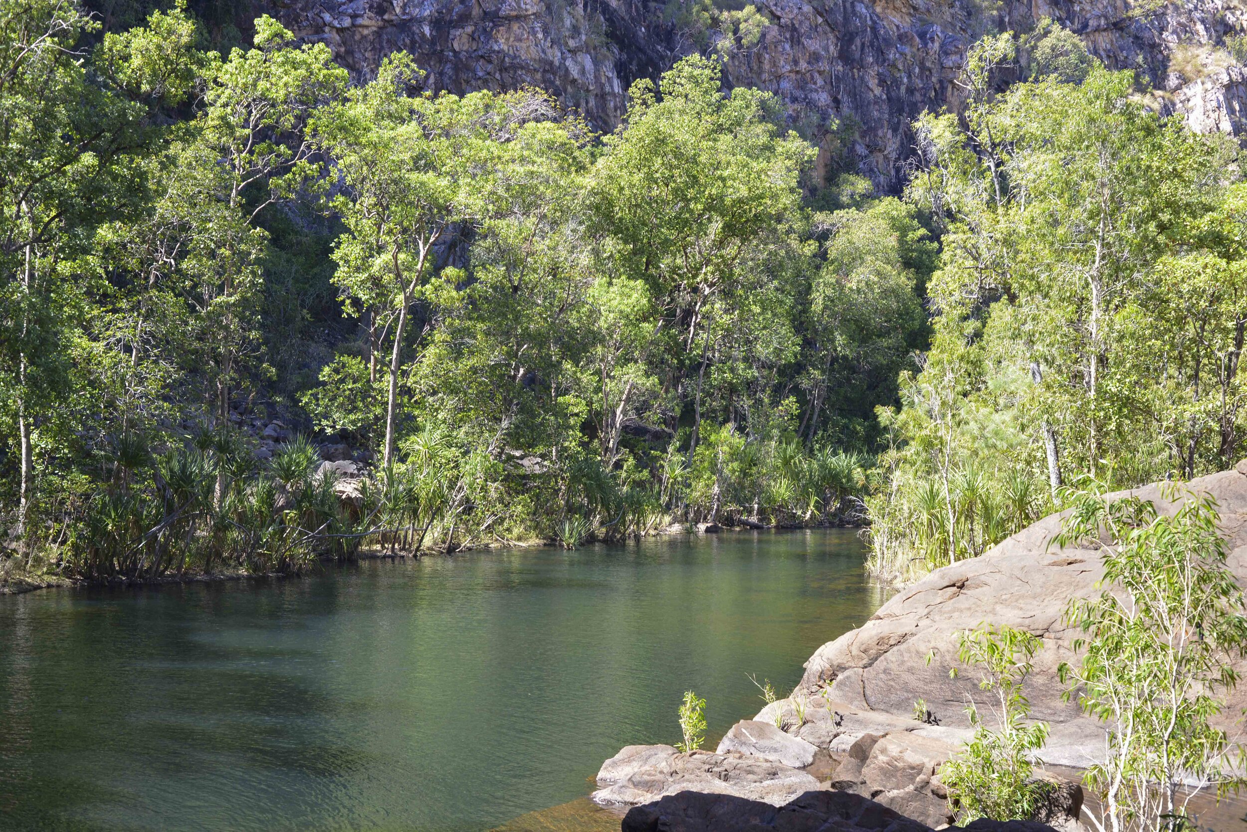
Crystal falls WOW! This swamp-fed falls lives up to its name the water is crystal clear. Large pools that are 20 to 30m wide and at least that long with “crystal“ clear water making the detail at the bottom of the 5m pools easily discernable. These pools flow into a wide river with rocks, rapids, and deep pools for the next few hundred meters before plunging over the edge of the escarpment. Crystal falls are rather secretive and getting a good viewing of the falls borders on the impossible. The falls tumble down into a narrow gorge with the gorge running at ninety degrees to the falls this scenario limits the ability to view the falls. The campsite is located next to the river under large shady trees. The afternoon was spent swimming, jumping of large rocks into deep pools, and exploring the area. After dinner, we are kept busy trying to catch the little shrimps whose eyes are responsible for the reflections in the water.


Day 3: Jatbula Trail
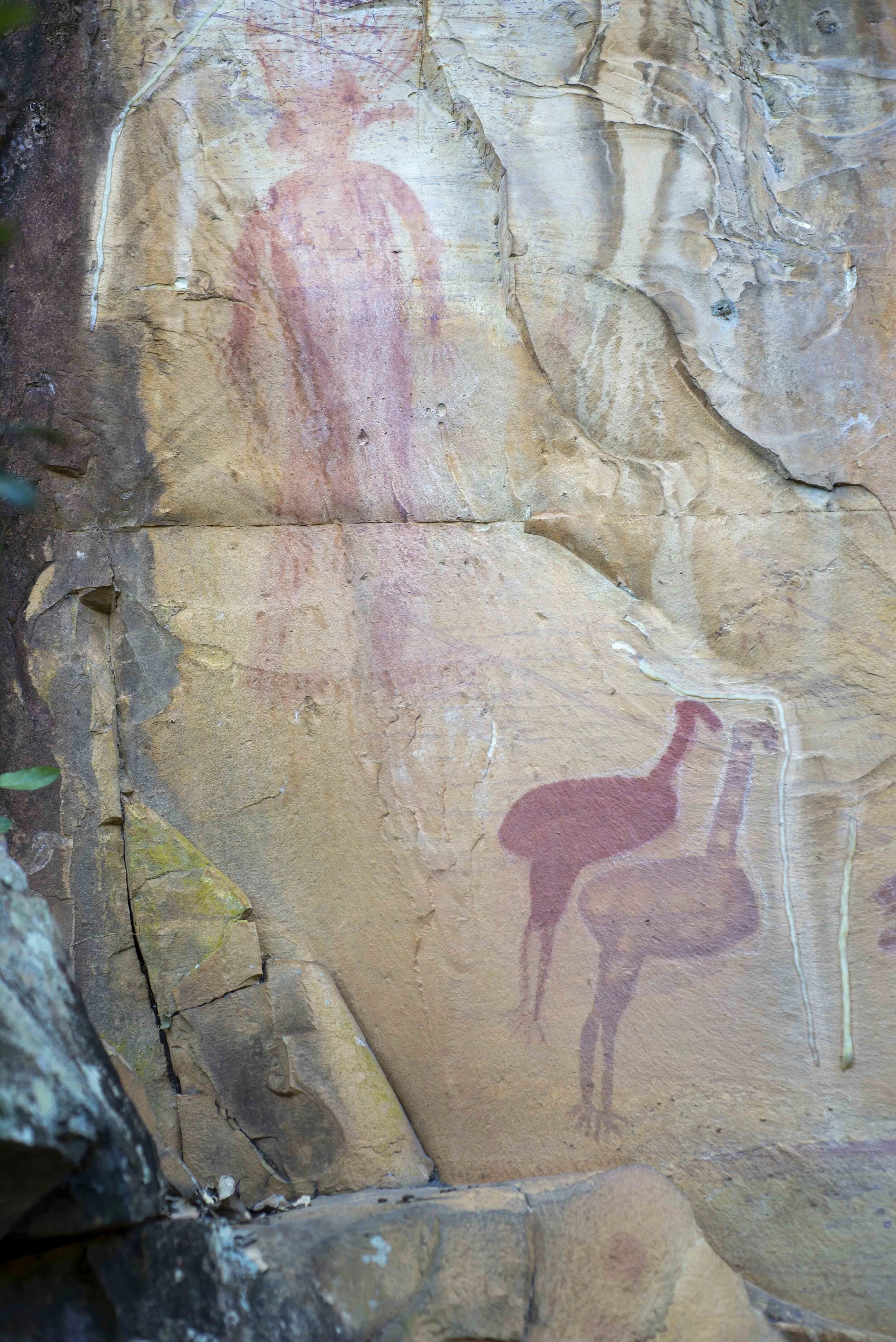
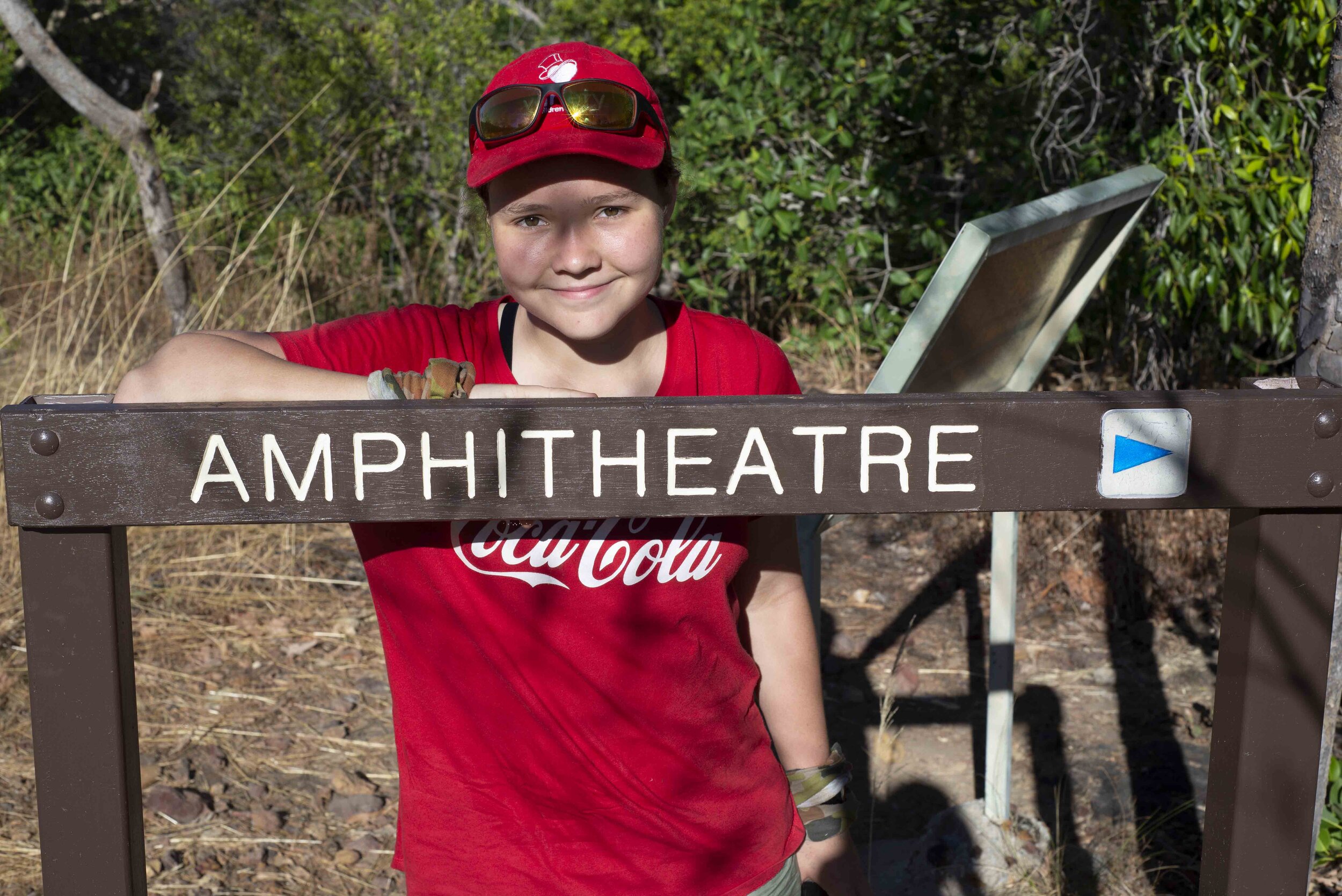
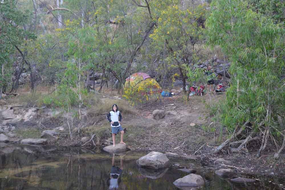
After a good breakfast, we set off with boots in hand to facilitate the river crossing and get day three of our hike underway. A 10 km hike from Crystal Fall to 17 Mile Falls. Shortly after starting the hike, you get the best view of Crystal fall and the narrow gorge that it descends into. The hike then ascends to its highest section at about 300m and meanders along very close to the edge of the escarpment. This provides occasional glimpses of the panorama below. After an hour and a half of walking (6.5 km), the Amphitheatre is reached. We stopped for snacks and drinks before climbing down the conveniently supplied stairs into the canyon. The canyon has sheer cliff walls with recesses and caves that provide the perfect accommodation and canvas for aboriginals and their art. The rock art is well preserved with an information board explaining the significance. Sheer cliff walls with roots hanging down, long tree trunks reaching up to the light, and waterfalls trickling down all made for a good spot to explore.
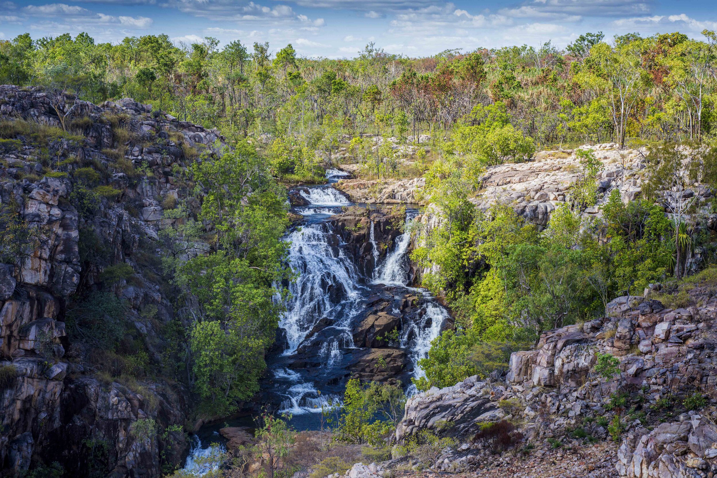
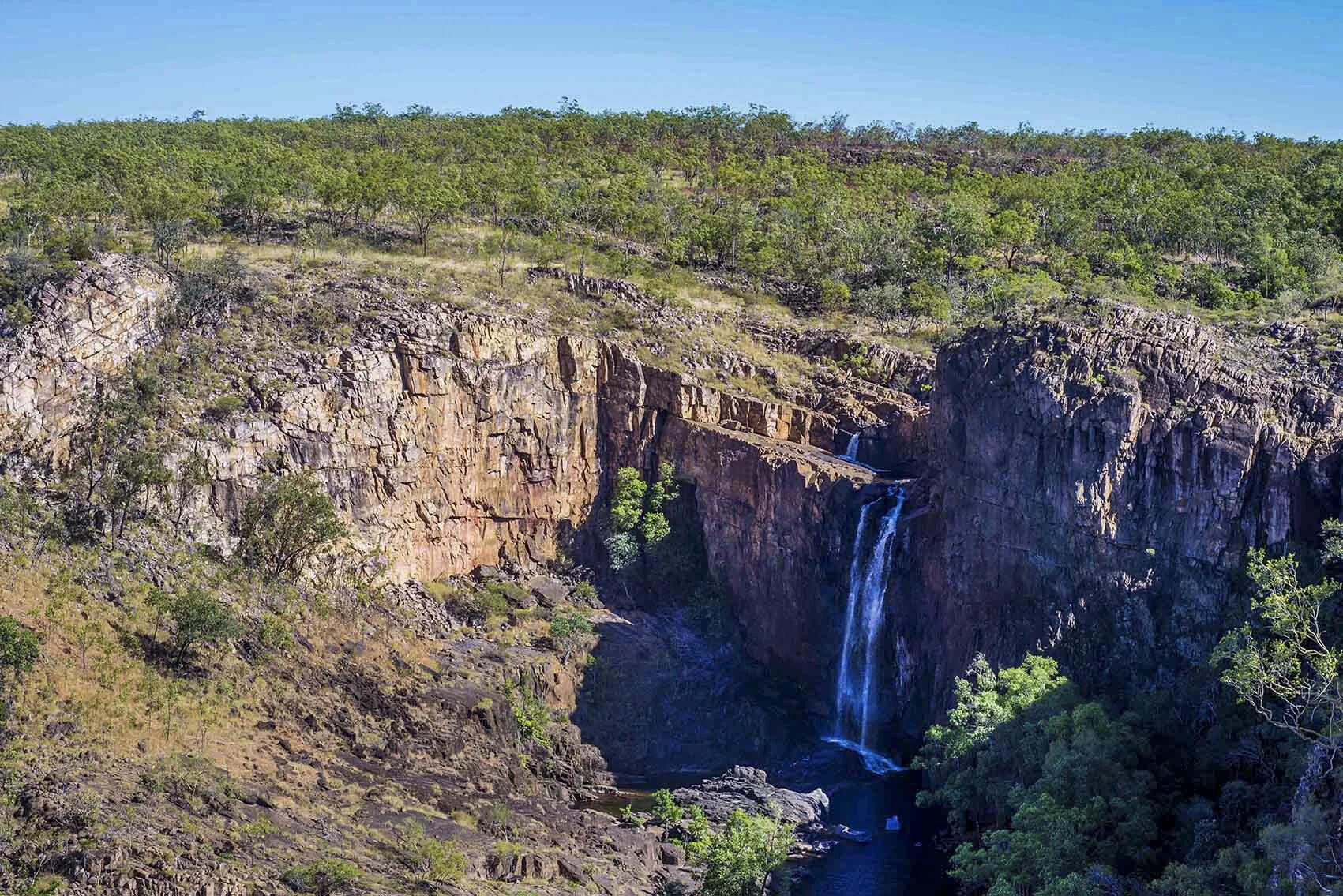
On returning to the top of the canyon we donned our packs and within an hour (3,5 km) found ourselves within sight of our overnight destination. As you approach 17 Mile falls you are rewarded with a great vista of the surrounding area and the falls plummeting over the rocky outcrop. Five minutes later and with the campsite in sight, the last obstacle. You cross over 17 Mile Creek and walk along the bank of the river to the campsite. The last 10 meters however has deep, soft, soggy, swampy soil that sees your boots disappear to ankle in brown ooze.
17 Mile falls campsite is on a flat section of rock very near the top of the falls. The stream above the falls is a rather narrow, clear stream of water. The water forms several shallow wast deep pools with a sandy floor that feeds into a rocky cascade and then tumbles over the precipice as 17 Mile falls. The water has carved out deep and some very large perfectly round holes in the cascade. As we tried to get a better view of the falls we found a path that led down the cliff area to the base of the falls. What a great place, deep green pools, at the base of the impressive 17 Mile waterfalls with shady trees on the far bank. You can get to the base of the falls and standing under the falls you can have your own natural shower.


Day 4: Jatbula Trail
The next morning we were up and on our way early as this was to be our longest day of hiking. The walk from 17 Miles falls to Sandy camp is close to 17 km. We did at least 5 km in the first hour our routine had become one of hiking for an hour, a short rest, and then repeating the process till we reached camp. We made excellent time and passed our fellow hikers having a long lunch at Edith River Crossing. In all honesty, we probably pushed too hard on this section and did not get to enjoy the surroundings as much as we could have. This is especially true for the last section before Edith Crossing and extending to Sandy camp where the track follows the Edith River. This section is often under shady trees with lily-covered ponds. We had a long lunch break under these shady trees and within a half-hour found ourselves at Sandy Camp.
Sandy camp is most defiantly the most picturesque of the overnight stops. Sandy camp, as its name suggests, is situated on a sandy beach under tall Paper Bark trees nestled alongside a huge billabong (pond). The water is clear, cool, and inviting. Freshwater was still running into the billabong providing us with good drinking water. The afternoon was spent lounging about in the shade and swimming. As the sun began to descend were treated to a spectacular sunset reflected in Sandy Camp Billabong. That night was spent recalling iconic Australian films and scenes from the movies with “The Castle “ taking the lion’s share.


Day 5: Jatbula Trail
Day five dawned with cold weather the result being a tendency to linger in the sleeping bags a little longer. Emerging from the tents in warm clothing we gathered in the sun for an early morning coffee and breakfast. The day would see us decide to press on and complete the hike. The colder weather made for great hiking conditions but less inclined to use the swimming holes that form an integral part of the experience. The lack of a fluffy pillow, a 1-inch sleeping mat, and a few other minor inconveniences may have also contributed to the adult population pushing for this option. The section from Sandy Camp to Sweetwater Pool is about 11 km and would normally be the overnight camp for day five. Our decision to finish the hike on day five meant we would cover 16 km to Edith Falls. This section of the trail follows the Edith River from Sandy Camp to Edith Falls. The track is mostly flat and easygoing. Emerging at Sweetwater pools we encountered the first people we had seen in five days. Sweetwater Pool is a popular hike from Edith Falls. A cold Coke and some ice creams from the shop at Edith Falls rounded of a great hike.
Take your time on the hike enjoy all it has to offer even at a leisurely pace you will still have plenty of time at the campsites. Once at the campsites get out and explore the surroundings, you never know what you may discover.