
Central Harts Range 4WD Track and Walk: Central Desert

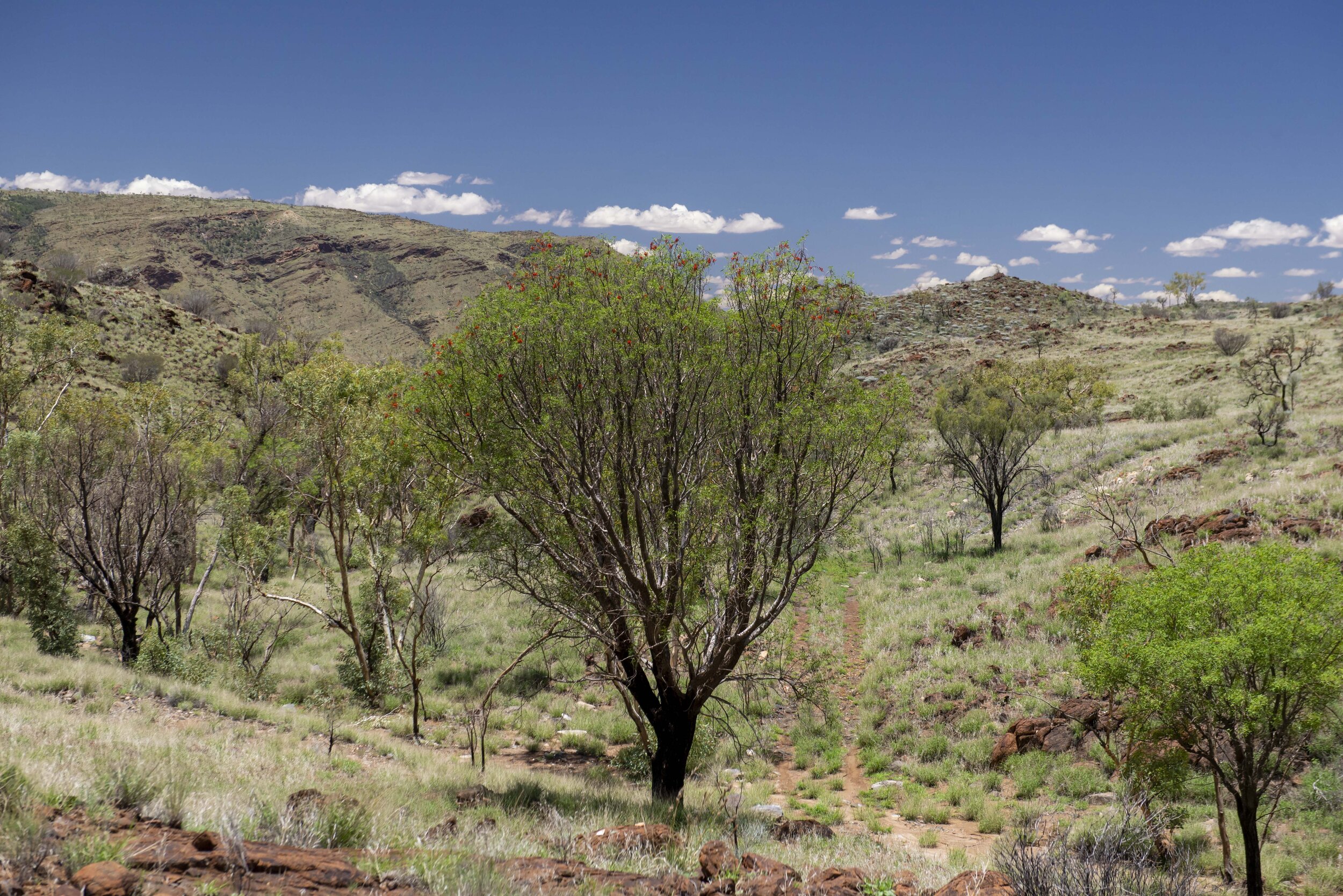
View from Mount Palmer
Central Harts Range 4WD Track and Walk
If you are in the Central Harts region this four-wheel-drive track and the subsequent walk to the top of Mount Palmer make for a great day out. The track is rocky but easily negotiated and provides access to the abandoned mica mines as well as exquisite panoramic views of the surrounding countryside. Once you get to the end of the track a steep walk takes you past several mines as you climb ever higher to the summit of Mount Palmer.
Mining in The Central Harts Range
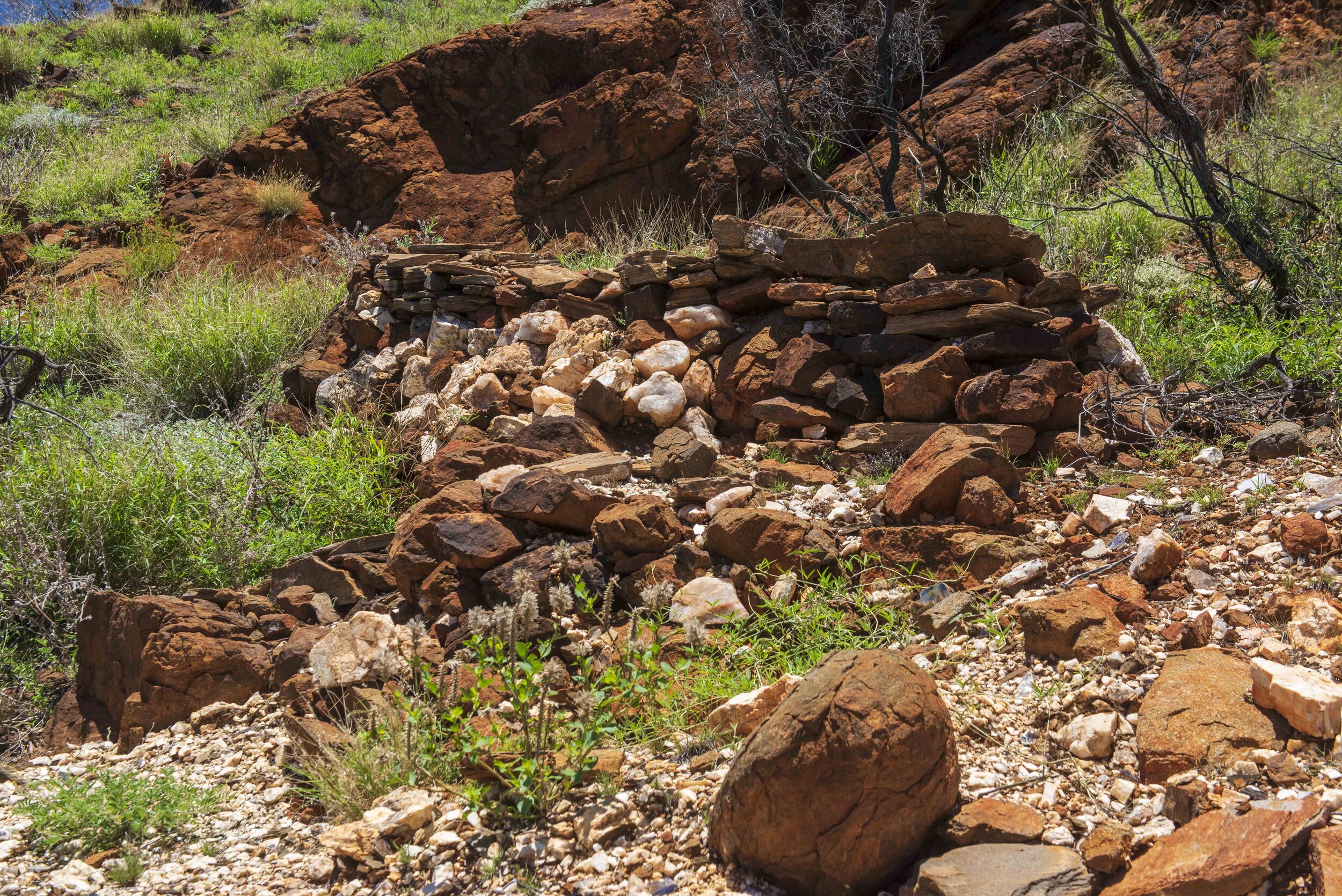
This track exists due to the efforts of miners digging for mica and remnants of the footpaths created by the miners are still evident on the walk up to Spotted Dog and Dispute mine. Mica mining in the Harts Range was initiated after mica became sought after in the UK in the 1880s. Mica has many uses but is particularly useful for capacitors and insulating high-voltage electrical equipment. Miners migrated north to these mica mines as it became evident that gold mining at Arltunga was not as viable. Mica was abundant but unfortunately, it did not survive the long journey to the UK with only about 5% reaching the UK in a usable state. Again, the poor viability led to miners looking for better options. Interest was rekindled after world war I when Italian immigrants began to mine the area. With the onset of world war two European sources of mica dried up and Harts Range became the largest supplier of mica in the world. After the war cheaper producers from Brazil and India led to the decline of mica mining in this region and by 1960 all the mines were abandoned. All mining was done on a small scale with shafts no deeper than about 100m and the mullock heaps, white, and shimmering remain on the side of the hills as evidence of past exploration.
Billy Hughes, Oolgarinna, Caruso mines, Spotted Dog, and Dispute mine are all located on Mount Palmer. The walk however takes you from Dispute Camp located at the base of the mountain past Spotted Dog Mine to Dispute Mine.
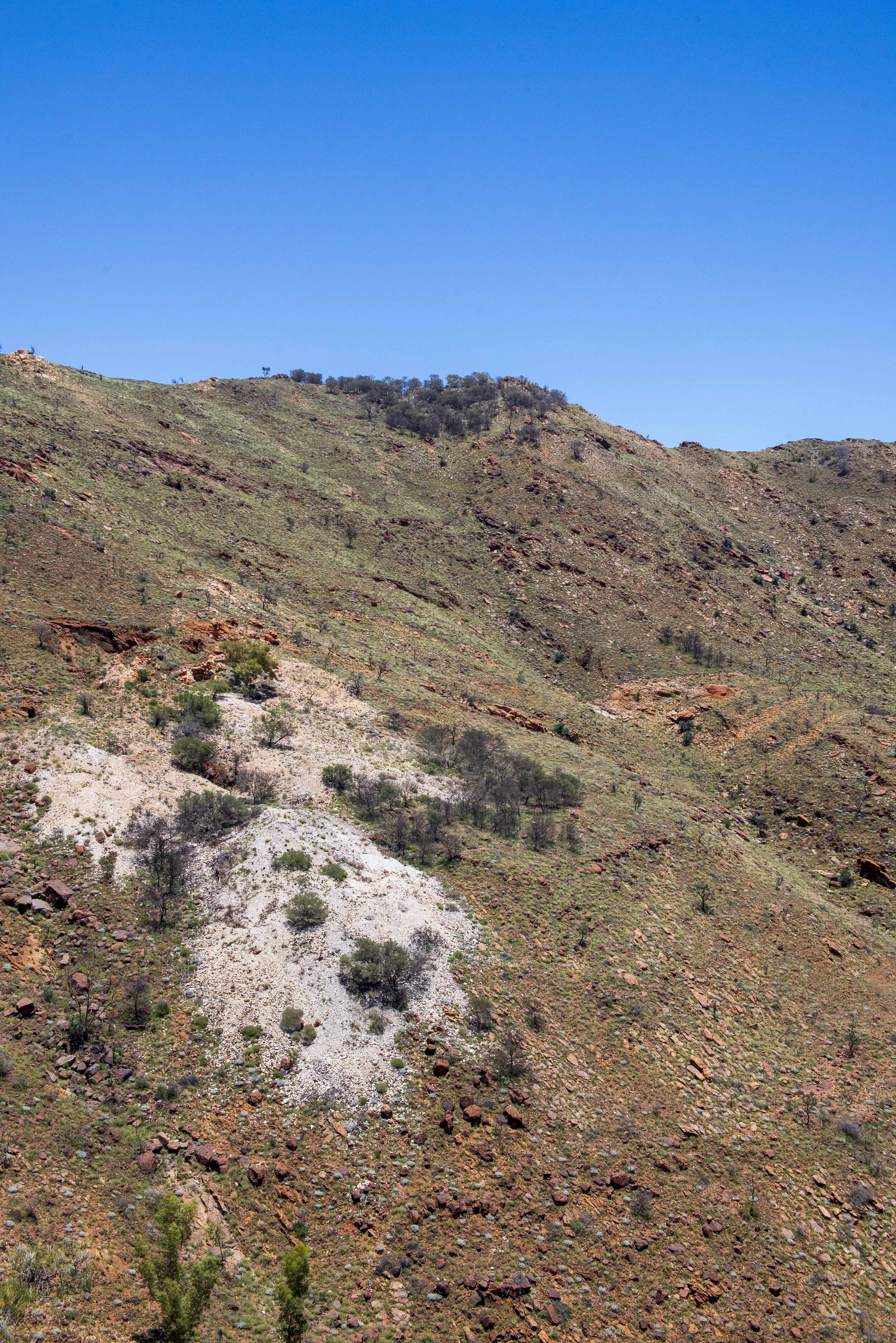

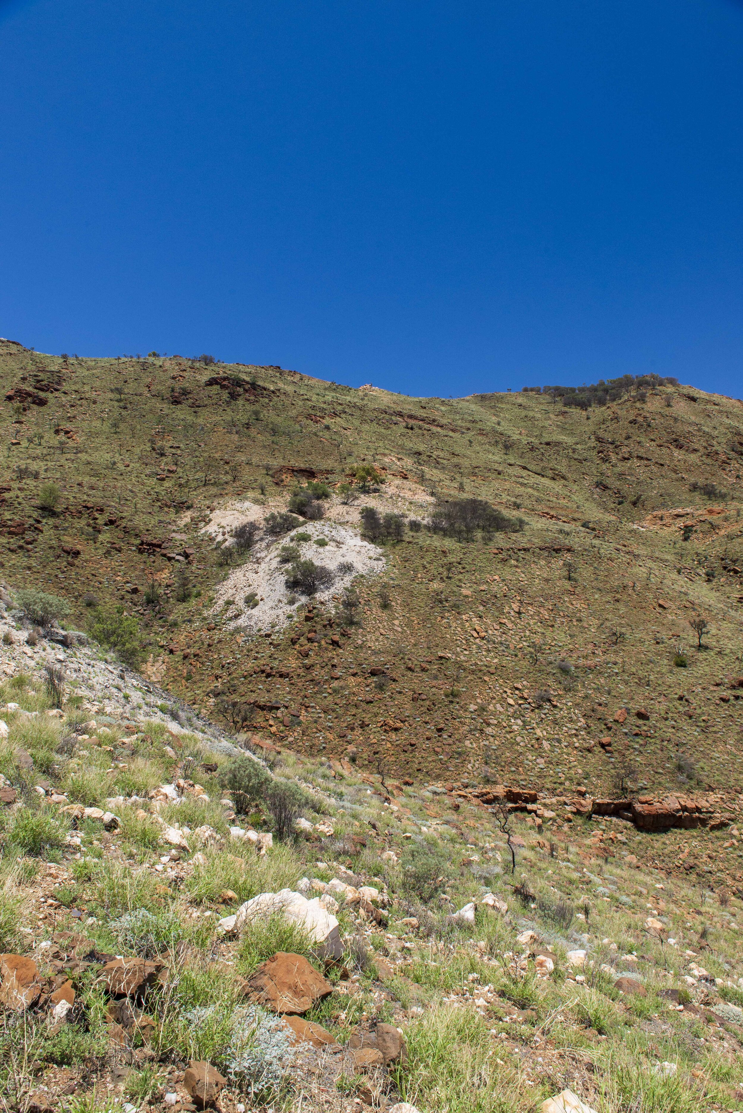
Spotted Dog Mine
‘The mine started around 1896, and was worked sporadically over the years, until it was closed after the deaths of two men from an underground collapse on the 07 August 1931.’ (https://www.mindat.org)
Dispute Mine
“The Disputed Mine seems to be the one everyone wants to get to when visiting Mount Palmer. Claimed to be the longest operational mica mine of any significance in the world. The glittering extensive mica dumps can be seen from the base, but high on the side of the mountain, it will not give up its treasures without an effort.
Many writers have expressed awe at the view from the mine over the ranges. One of the best found was Elizabeth Powell in 1947 (The Advertiser newspaper, White Wealth in the Red Heart, 06/12/1947), and gives an idea of the dumps as well when the mine was operational:
'Large mica blocks have been taken from the mines including the Disputed, far up against the summit of Mount Palmer. The immensities of distance surveyed from this mine are unforgettable. Only the hardy or rash however would care to make the climb. Seen from a mile below, the glittering mica dumps above look like a spilt sugar bag. A rough camel track winds over the tents and creek bed, and aborigine huts of the mining camp at Disputed.’
After gouging out the mica, the miners would sit above ground, wearing bibs made out of car tyres, splitting the mica with sharp knives. Once a 1 mm thick sheet was prised from the 'book' it was held to the light to be inspected for inclusions or markings (called staining by the miners). Only the clearest mica was taken, the rest is thrown on the dump. The mica was then carefully packed in cases and carried by hand down the mountainside.
The mine started around 1896. A Sydney company tried to jump the lease from the then owner Simon Rieff, and litigation followed in the Adelaide courts. So, the Disputed mine got its name. At what date this occurred is uncertain as Rieff never arrived at Alice Springs until 1919.
Giovanni (John) Spurio owned the mine in the 1940s and 50s. The mine was the last to close in the area, being 1960. Ownership details are incomplete, and like many of the mines on this field, little was recorded.” ( https://www.mindat.org )


Getting There
From Alice Springs travel north on the Stuart Highway then travel along the Plenty Highway to Atitjere some 215km from Alice Springs. To access Mount Palmer, you will need to travel through aboriginal land, permits are not required but you are asked to check with the Atitjere Council office (next to the community store) before proceeding to Mount Palmer. Conditions of access may be subject to change and it is best to check with the community before undertaking this trip.
Atitjere (pronounced “a-DITCH-air-uh”) community with about 400 to 500 residents is nestled at the base of the Harts Range. Descendants of the Aboriginal people who would have worked in the mines and some like David Jinka and Louis Schaber still have childhood memories of the working mines. These folks would have helped miners transport supplies to the mine, work on extracting and refining the mica and help with transport of the mica to the market. A police station and store can be found in the town with the store offering fuel, a good selection of groceries, hot food, ice-creams, drinks, payphone, ATM Machine. Don’t miss the annual Harts Range Amateur Race Day normally held over a weekend in early August that features stock-horse races, rodeo, gymkhana, sports events including running races, novelty races for kids, etc.


The Track
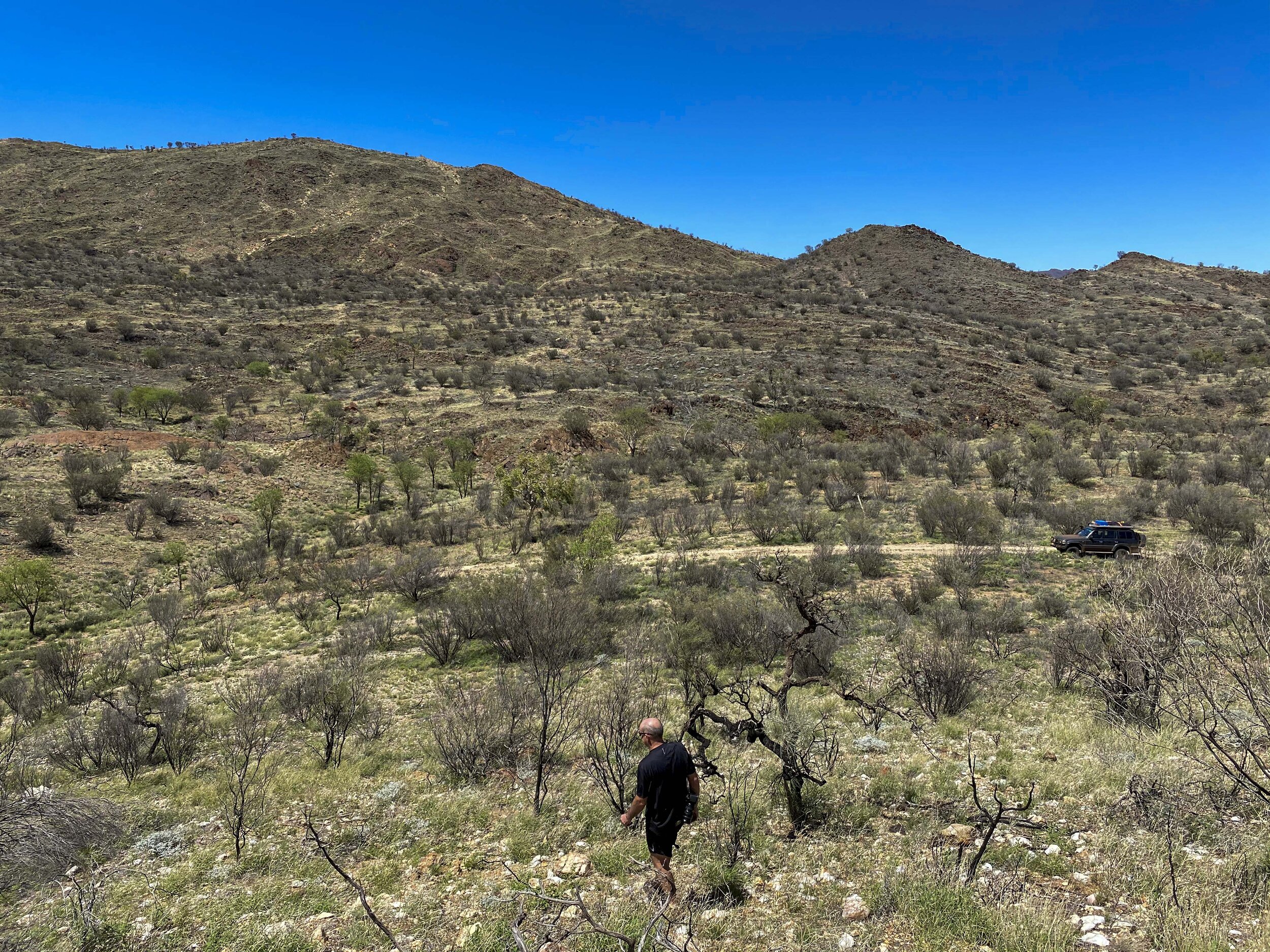
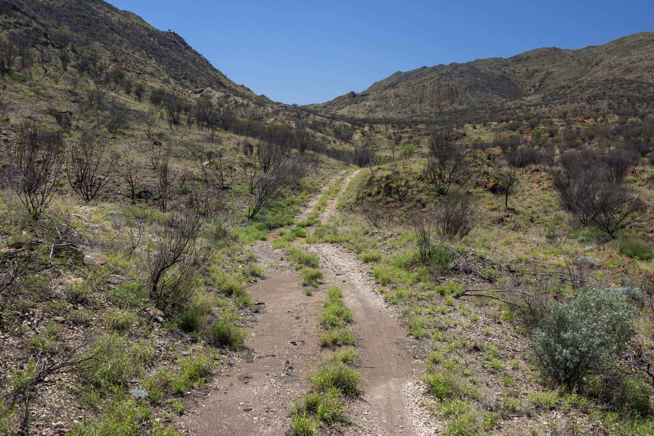
From the Harts range Police Station located on the Plenty Highway, near Atitjere, head west for 580m and then make a left turn to head in a south-westerly direction along Spotted Tiger Road a graded dirt road. Veer right at 5.5 km (near the racecourse) and follow the road for a further 2.5 km to reach the Spotted Tiger Campground. If the campground manager is about let them know you are heading up to Mount Palmer. From The campground, the road becomes a two-wheel track. The track is mostly in good condition with some of the steeper sections undergoing some erosion. A high clearance four-wheel drive is recommended for this section. From the campground, follow the track for 4 km to a point where the track forks; the left fork leads 1 km to the Rex Mine, while the right fork leads you to Dispute Base Camp after about 2km.
The remnants of Dispute Mine Base camp can still be found at the foot of the valley alongside a dry riverbed. The partial remains of stone-stacked walls with a kitchen hearth and oven can be seen. Corrugated iron water tanks and other structures are also to be found aw you walk up the valley.


The walk
Shortly before Dispute Mine Base camp a two-wheel track veers off to the right and starts the ascent of Mount Palmer. This track ends on an elevated section above the base camp with excellent views both up and down the valley. From this point, you need to walk to access Spotted Dog, Dispute Mine, and for those that are very keen the summit of Mount Palmer. A faded sign indicating the start of the walking trail, the start of the trail is to the southeast of this sign. The trail has been marked with large white arrows mounted on fencing poles however the trail and these markers may be difficult to find at times. The walk to the summit of Mount Palmer is about 2 km as the crow flies. You will pass by Spotted Dog Mine and then Dispute Mine on the walk to the summit. DON’T BE FOOLED by the relatively short distance. This is a very steep climb and that helps to put some perspective on what the miners had to endure. The walk follows an old mining path and evidence of work done to create a more even pathway can still be seen on the walk. Time constraints and a lack of what was to be expected on this track meant we did not get to the summit of Mount Palmer. Be prepared for the steep climb, take it slow, and enjoy the panoramic views. Walk around the old mines to get a feel for what the miners must have endured.


What to explore in the area
Gemtree
Gemtree has a lot to offer and is well worth the stopover. From March to October take a fossicking tour and discover your very own gemstones. Caravans, camping, and very affordable accommodation is available. Gemtree country store offers limited groceries, takeaway meals, tea and coffee, fuel, ice, limited internet access, and a payphone. The local and very friendly owners provide a wealth of information on other activities in the area.
The Mac and Rose Chalmers Conservation Park
Some 90 km from Atitjere along the Binns Track you will find this conservation park. Offers bush camping, hikes, and scenic views. Visit nearby Mt Swan with a gallery displaying Utopian Art. They also provide B&B-style accommodation.
Box Hole Meteorite Crater
Is meteorite crater 170 metres in diameter, with the rim being about 10-17 metres above the crater floor. Meteoritic metal found at the site including an iron mass of 82 kg now in the Natural History Museum, London. This site is on private land and is not signposted. The site is about 60km from Atitjere along the Binns Track. Talk to the friendly folks at Gemtree for more detail. The crater is located near Dneiper homestead and permission is needed to explore this site.
Fossicking Areas
Hearts Range West fossicking area located 34 km east of Gemtree on the Plenty Highway. This area is on Mt Riddock Station as such close any gates after you and do not interfere with cattle. A smaller fossicking area can be found on the Binns Track. Bush camping is allowed on these sites. For more detail visit The NT government website.
Mud Tank Fossicking area can be found by taking Plenty Highway 7.7 km east from the Gemtree Caravan Park then turn off to the south and follow the direction. Bush camping is allowed on this site. For more detail visit The NT government website
Conclusion
Only a few hours from Alice Springs and you will discover all the secrets of the Harts Range, come on out and explore this region and you may go home with a rare gem in your pocket.