
Southern Walks & Trails Nitmiluk National Park (Katherine Gorge)
Waleka Track
Southern Walks & Trails Nitmiluk National Park (Katherine Gorge)
A maze of variable walks and hikes is available on the southern banks of Katherine Gorge. With short, moderately difficult walks of 1.8 km up to Baruwei Loop and its lookout over the Katherine River. In contrast, a hike to the Eighth Gorge, including a look at Jawoyn Valley, is close to 39 km long and considered moderate to difficult.
We took a mix of trails to explore the area.
Gurumal Trial to the Southern Walks. (1.8km)
Windolf track for (0.4 km)
Yambi track for (2.1 km)
Waleka track (5.9 km)
Lily Pounds (0.47 km)
Waleka track (1 km)
Smitt Rock (1.6 km) – overnight
Dunlop Swamp (3 km)
Yambi track (5 km)
Yawoyn Valley (5.6 km)
Yambi track (5.9 km) – back to Dunlop Swamp
Yambi track (7.1 km) – back to camp
Gurumal track (1.8 km)
Total distance 42 km
Southern walk undertaken in this review
DAY 1
Gurumal Trial to the Southern Walks (1.8km)
You head past the ranger station from the campsite and follow the pathway adjacent to Gorge Rd until it turns away from the road to do the steep climb up the escarpment. The climb up the escarpment is very steep but relatively short and follows a vehicle dirt track to the top. Follow the yellow triangular trail markers. Once near the top, locate the starting point for the southern walks.
Windolf track (0.4 Km)
Marked with green triangular trail markers. This short section of dirt road continues the climb but with less gradient. After 400m, you find the water tank that provides drinking water. At this point, take the Yambi track.
Yambi track (2.1 km)
Marked with blue triangular trail markers. This car track/road meanders up and down and is quickly followed. The track is broad, easy underfoot, with some taller trees providing some shade. This section ends with another water tank that provides drinking water. A minimum of 3 litres of water is advised; take more if you can. The next portion has no reliable water till you get to Smitt Rock and can access the Katherine River at the bottom of the gorge. Note this is water taken from the river (no water tanks providing fresh water in this section), and drinking this water is at your own risk. At this point, we left the Yambi track and started the Waleka track.


Waleka track (5.9 km)
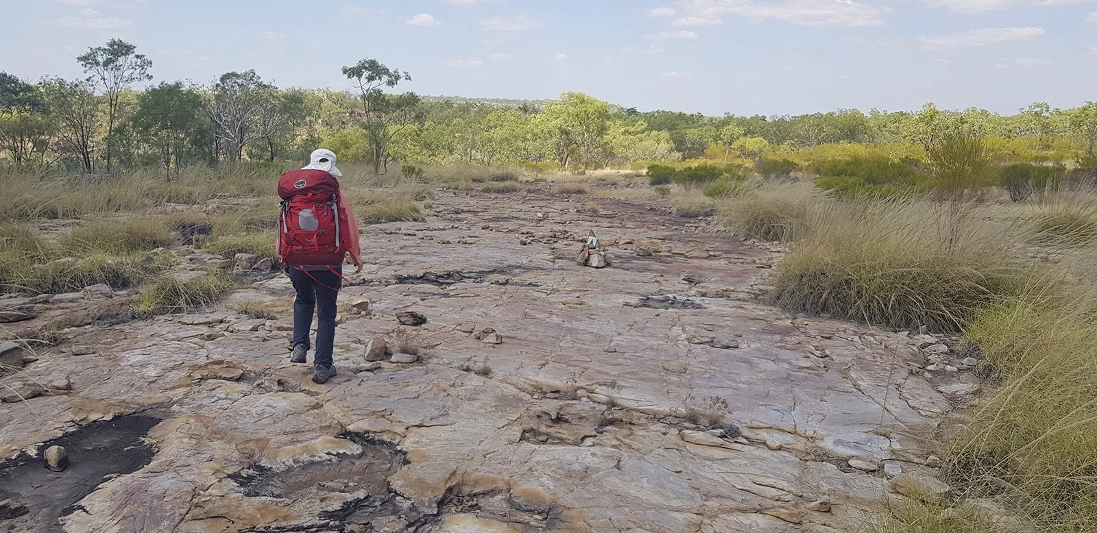
Marked with green triangular trail markers. The track now leaves the road and becomes a walking track as you climb up the valley for 200m. The path splits into three at this point and can be a little confusing. The orange triangles follow the bottom of Butterfly Gorge till it reaches the Kathrine River. The Waleka trial (green triangle) comes together at this point. The northern branch takes you back to Jedda's Rock – don't take this option. The southern branch is the track to take. Signage at the start of the trail provides the following warning. Wilderness trail with steep and rough sections, limited drinking water, and possible extreme temperatures. Suitable only for experienced hikers who are prepared to camp overnight.
This section is grade 5, difficult (Australian Walking Track Grading System) and certainly lived up to the warnings. The track initially follows the escarpment to the south of Butterfly Gorge and then along the southern section of Katherine Gorge. The vegetation is primarily low trees and scrubland with very little shade. The path is predominantly on rock, with occasional steep areas where shallow gorges must be negotiated. The trail is not well worn and can be difficult to find at times. Finding and following the walking arrows is the only way to navigate sections. The lack of shade and radiant heat from the rocky path adds to the difficulty factor.
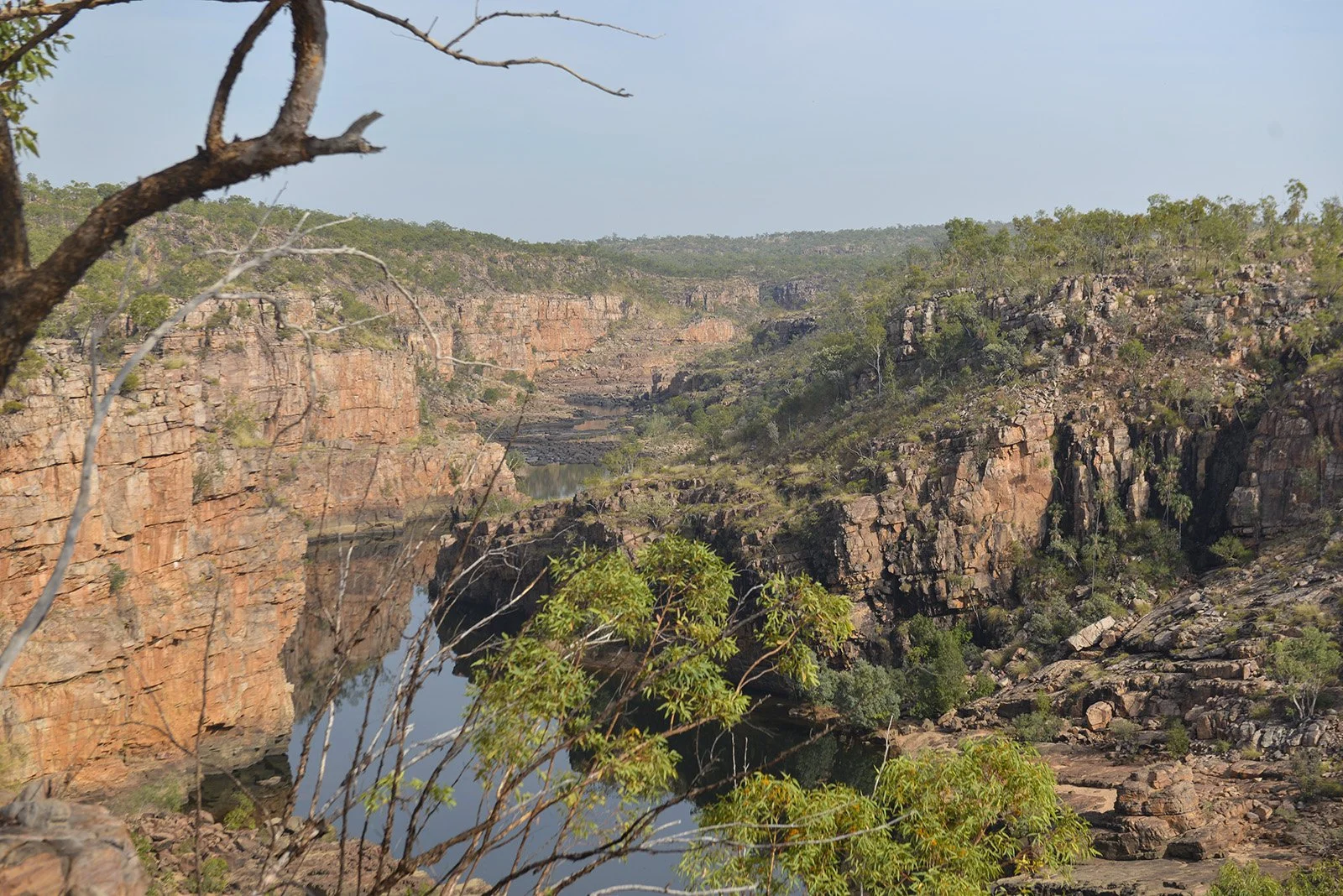
If you expect sweeping, dramatic views into the Katherine Gorge, you will be disappointed. The track only approaches the gorge's edge once towards the end of the second gorge, where the river can be seen cutting its way below the steep red cliffs. For the most part, the landscape is flat to undulating low scrub.


Lily Pounds (0.47 km)
After 5.7 km of walking the Waleka track, you reach Lily Ponds, a large shallow body of water that may become stagnant towards the end of the dry season. The pond feeds a small stream that then cascades over the gorge's edge. By June, this was a tiny trickle still flowing over the edge. We rested up here and took a quick swim before moving on.
Waleka track (1 km)
Returning to the Waleka track (green triangular markers) emulates more of the same escarpment rock and low scrubland with a challenging trail to follow. This section will get you to the junction that will take you to Smitt Rock.
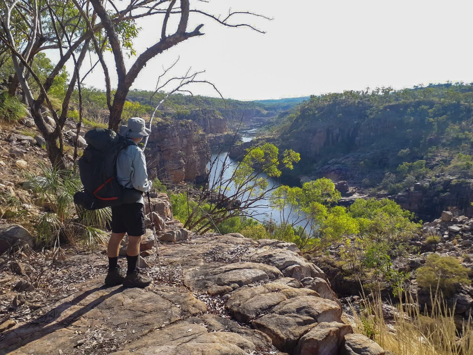


Smitt Rock (1.6 km)
Marked with orange triangular trail markers. Towards the end of this track, you hike along the edge of Katherine gorge, and it provides excellent views into the fourth gorge. As you approach Smitt Rock, the view from above makes it evident that it is an island structure. This is not apparent when you are in the gorge canoeing, as the sheer size of the rock hides its island status.
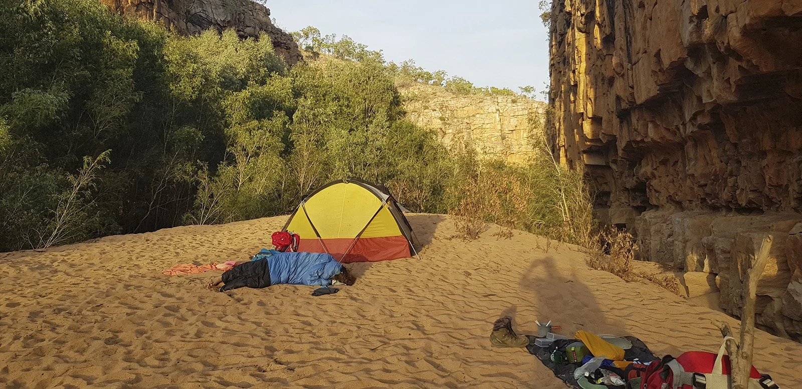
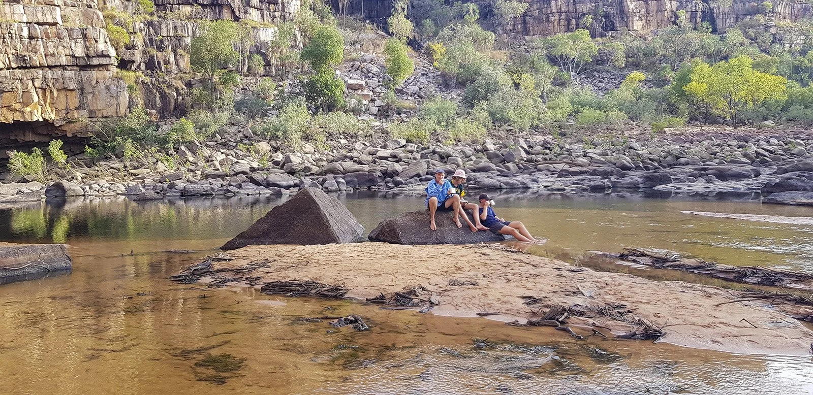
Smitt's Rock campsite located on the escarpment is rather dreary. A composting toilet and access to an emergency contact devise that marks the campsite. The site has no drinking water or other water available and is poorly shaded and not very inviting. A much better option is to camp next to Smitt Rock at the bottom of the gorge. However, the hike to the valley's base is near vertical and will take at least another half to one hour to negotiate. It is well marked with walking triangles marking the Trial to the beach to the south of Smitt Rock. This is a much better campsite. Sandy beach with good shade to camp, the river is easily accessible for swimming and relaxing. All the tourists have left by late afternoon, and you have the gorge to yourself. The late afternoon and early morning provide excellent light to photograph Smitt Rock. The climb down the gorge is well worth it. Make use of this camping site.


Day 2
Smitt Rock to Dunlop Swamp (3km)
Marked with orange triangular trail markers. Early morning and the steep walk out of Kathrine gorge onto the escarpment and an undulating track to Dunlop Swamp. A challenging trail to follow with this section qualifying as a grade 5, difficult hike. Dunlop Swamp has a water tank that provides drinking water. The camp area is under some larger shade-providing trees; however, swimming is only available early in the dry season, and by June, most of the water is stagnant. I would only camp here if no other alternatives are available. We leave our hiking bags here, take water and a daypack, and head out on the Yambi track towards Yawoyn Valley to view rock art.


Yambi track (5km)
The Yambi track is marked with blue triangular trail markers. This car track/road is quickly followed and relatively flat. The route is wide, easy underfoot with primarily sandy soil and some taller trees providing some shade along the way. At the end of this track is a water tank that provides drinking water.
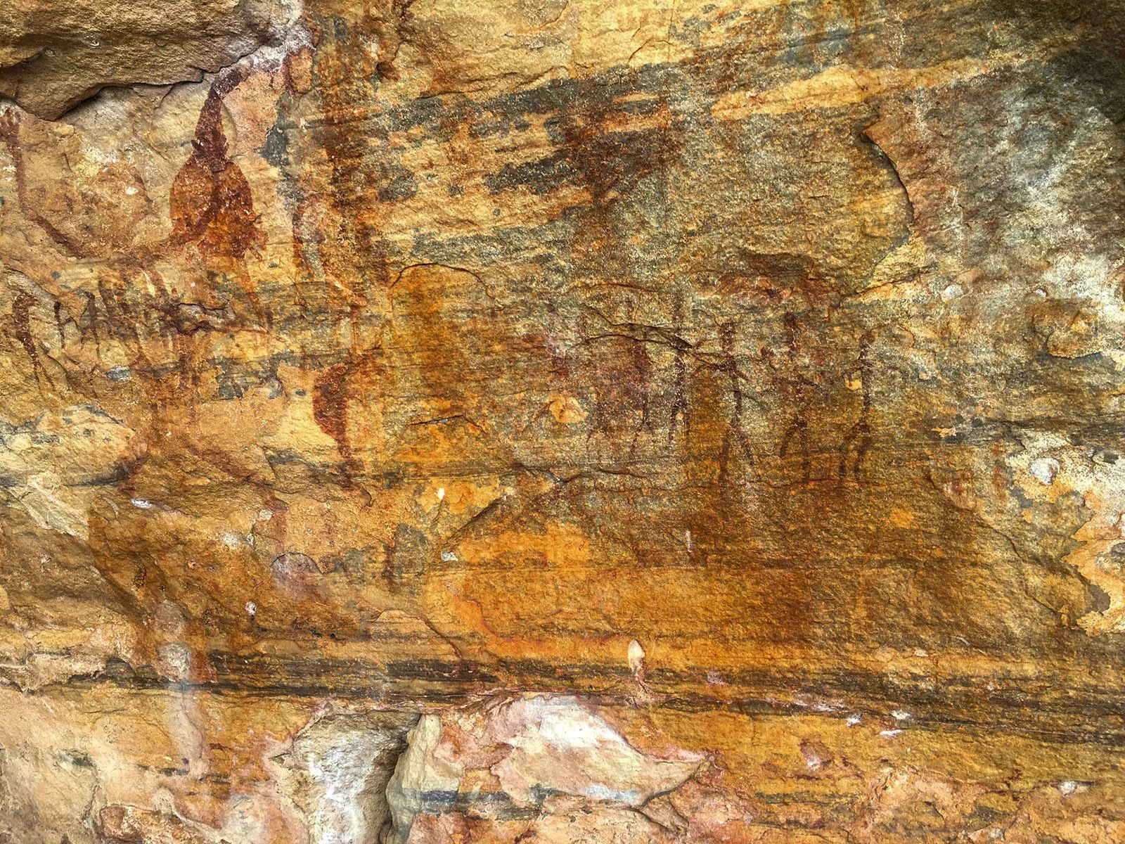
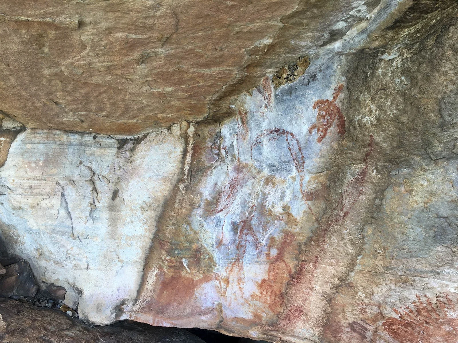
Yawoyn Valley track (5.6km)
Fill up your water bottles before doing the valley walk. This walking track heads out with red triangular trial markers, the path is often challenging to locate on the initial stage (western section), and no rock art is to be found in this section. The walk is not very interesting, and my advice would be to walk in and out on the eastern section where the rock art is to be seen. The east branch of the walk has some good panoramic views and unusual rock formations. Many rock paintings can be found in this section.


The Walk Home
Yambi track (5.9)
The Yambi track is marked with blue triangular trail markers. The first 900m of this track is very rough as you climb up a boulder-strewn gorge and head back to the water tank.
Once back at the water tank, you follow the same road you came on, back to Dunlop Swamp.
Yambi track (7.1 km)
Blue triangular trail markers show the way along this two-wheel vehicle track towards the campsite and home. Water tanks providing drinking water at Dunlop swamp and additional water tanks can be found along with the road home. A long walk, but the track is easy to follow and mostly even underfoot.
Gurumal track (1.8 km)
The home stretch back down the escarpment and into the camp.