
Daly Waters History; John McDouall Stuart
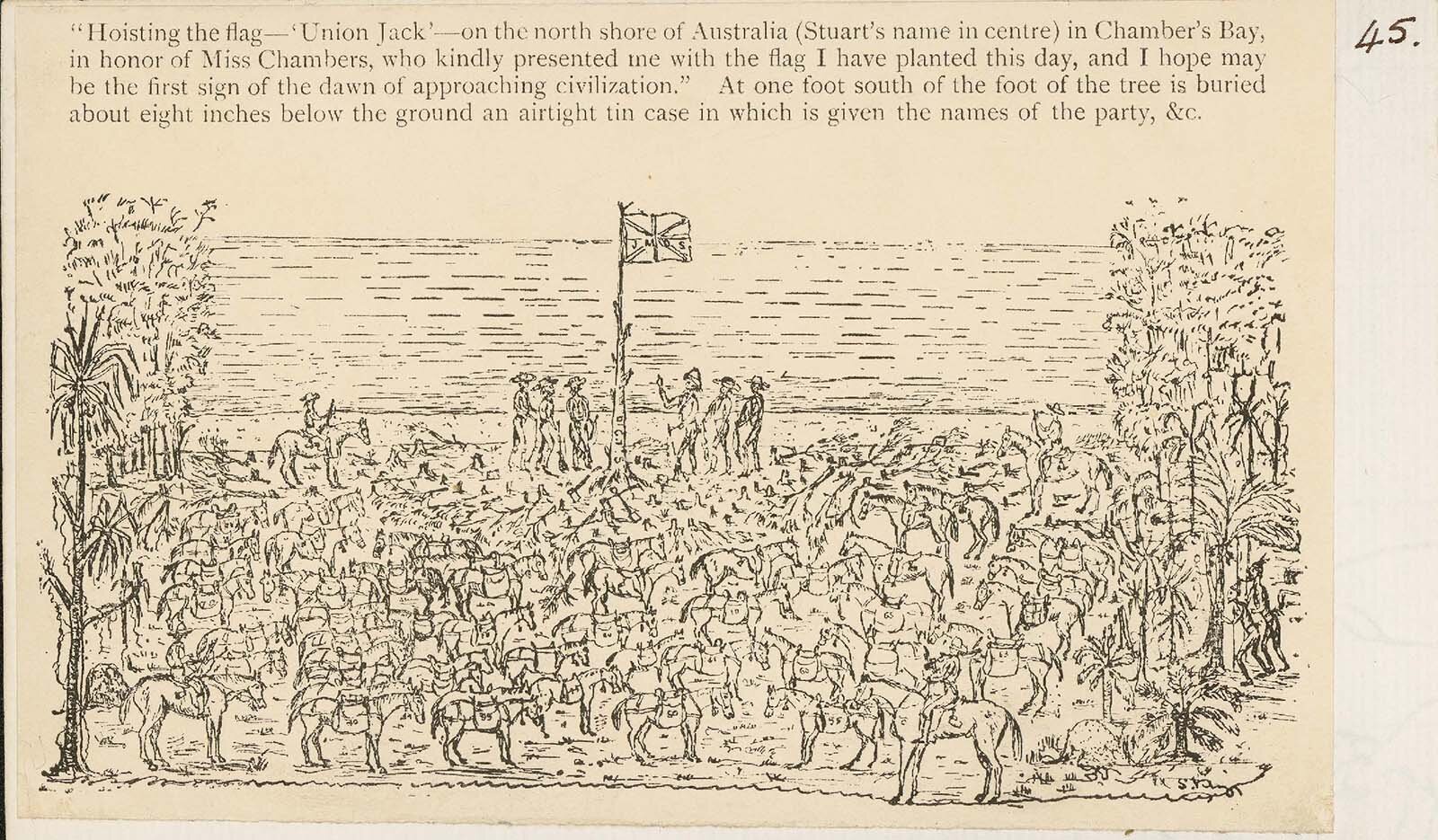
Stuart Hoisting the flag on the north coast at Chamber’s Bay. (Photo 45)
John McDouall Stuart discovery of Daly Waters
Stuart had undertaken 5 expeditions before his successful south-north, crossing of the Australian continent. His fourth expedition in 1860 was his first attempt to cross the continent and he managed to travel to Attack Creek, just north of Tennant Creek. The second attempt was in 1861 where the party managed to get to Newcastle Waters. They spent two months (23rd May to 11th July) in the Newcastle Waters area trying unsuccessfully to find a route to the north. The harsh low scrubland, open plains, and lack of water accounted for this failure. (1)

John McDouall Stuart
(7 September 1815 – 5 June 1866)
Stuart's initial motivation to cross the continent may have, in part, been the 2000 pounds prize. The prize was offered by the South Australian government to the first European to cross the continent. However, due to Stuart's success in the first attempt to cross the continent, he was then able to secure financial backing from the South Australian government for his subsequent expeditions.
The driving force behind the government's encouragement of this exploration was the need to establish a route for an overland telegraph line that would join Adelaide to the rest of the world.
The parameters for the Stuart sixth expedition and his third to cross the continent changed before his departure. Instead of trying to reach the Victoria River that lay to the northwest of Newcastle Waters (a very dry and unforgiving area), he was to head for the mouth of the Adelaide River and thus head in a northerly direction from Newcastle Waters. A plausible reason for this change was that the mouth of the Adelaide River was earmarked as a potential site to develop the new settlement in the north. This (failed) settlement however only took place in 1864 at a site known today as Escape Cliffs. It was this chain of events that drove the exploration northwards towards Daly Waters. (1)
Stuart's sixth expedition and the third (successful) attempt to cross the continent was from December 1861 to December 1862.
The party reached Newcastle Waters on the 5th of April 1862
Over the next month, Stuart works his way north along a line of waterholes that lie to the west of the present-day Stuart highway. These waterholes are
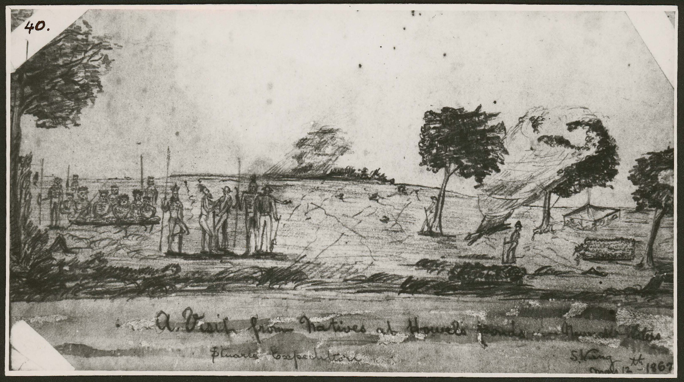
Howell Ponds, 16th April.
Frew's Water Hole, 15th April
King's Ponds, 16th May (exact location?)
Nash Spring, 9th May (exact location?)
Auld's Ponds, 20th May
McGorrerey Ponds, 21st May
Stuart discovers Daly Waters as described by Stuart in his journal.
Friday, 23rd May, McGorrerey Ponds.
We have now passed some fine holes of water, which will last at least three months; at five miles the water is becoming more plentiful and the creek broader and deeper, but twisting and turning about very much, sometimes running east and then turning to the west and all other points of the compass. Having seen what I consider to be permanent water, I shall now run a straight course, 20 degrees east of north, and strike it occasionally to see if the water continues. I have named these Daly Waters, in honour of his Excellency the Governor-in-Chief. Within a hundred yards the banks are thickly wooded with tall mulga and lancewood scrub; but to the east is open gum forest, splendidly grassed. Proceeded, occasionally touching the creek, and always found fine reaches of water, which continued a considerable way. At thirteen miles they become smaller and wider apart; at fifteen miles the creek seems to be trending more to the eastward, its bed is now conglomerate ironstone, and, as this appears to be about the last water, I shall give the horses a drink and follow it as far as it goes. In a short distance it has become quite dry, with a deep broad course upwards of twenty yards wide. At seventeen miles it separated into two channels, and at a quarter of a mile the two channels emptied themselves into a large boggy swamp, with no surface water. (2)
On the 27th of May Stuart sets up base camp at Daly Waters.
Most of the entries in the journal during this period describe the days exploring north of Daly Waters looking for the next water hole. The only description we have of the camp is as follows:
Once again from Stuart's journal.
Saturday, 31st May, Daly Waters.
There are a number of small fish in this water, from three to five inches long, something resembling a perch; the party are catching them with hooks; they are a great relish to us, who have lived so long upon dry meat. Any change is very agreeable.(2)
Finding the next waterhole proves difficult and the party remains at Daly Waters till 10 June when they move on to Purdie Ponds.
On the return journey back to Adelaide after successfully reaching the north coast of Australia Stuart again makes use of Daly Waters.
Tuesday, 26th August, Daly Waters. I feel a little better this morning, but still very weak and languid. I shall give the horses and myself a rest to-day, for I am quite unable to ride. Wind, south-east, with a few clouds from the same direction. (2)
Stuart and his party were the first Europeans to visit Daly Waters and make use of its good water supply.
As a closing note, Stuart makes no mention of marking any trees in Daly Waters.
References
1)John McDouall Stuart SocietyJOHN McDOUALL STUART – SURVEYOR-EXPLORER, 1815 – 1866. . Available, http://johnmcdouallstuart.org.au/ Accessed March 14, 2021.
2)John McDouall Stuart SocietyJOHN McDOUALL STUART – SURVEYOR-EXPLORER, 1815 – 1866. . Available, http://johnmcdouallstuart.org.au/729-2 Accessed March 14, 2021.
Photo 45. State Library of South Australia (2nd Apr 2019). King's sketches. In Website State Library of South Australia. Retrieved 13th Mar 2021 18:05, from https://digital.collections.slsa.sa.gov.au/nodes/view/624
Photo 40. State Library of South Australia (2nd Apr 2019). King's sketches. In Website State Library of South Australia. Retrieved 13th Mar 2021 18:05, from https://digital.collections.slsa.sa.gov.au/nodes/view/624
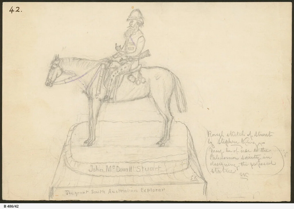
Drawing B-486-42. State Library of South Australia, John McDouall Stuart [B 486/42] • Artwork. Approximately 1862. https://collections.slsa.sa.gov.au/resource/B+486/42 John McDouall Stuart, the great South Australian Explorer'. 'Rough sketch of Stuart on horse by Stephen King (may be of use to the Caledonian Society in designing the proposed statue)'.
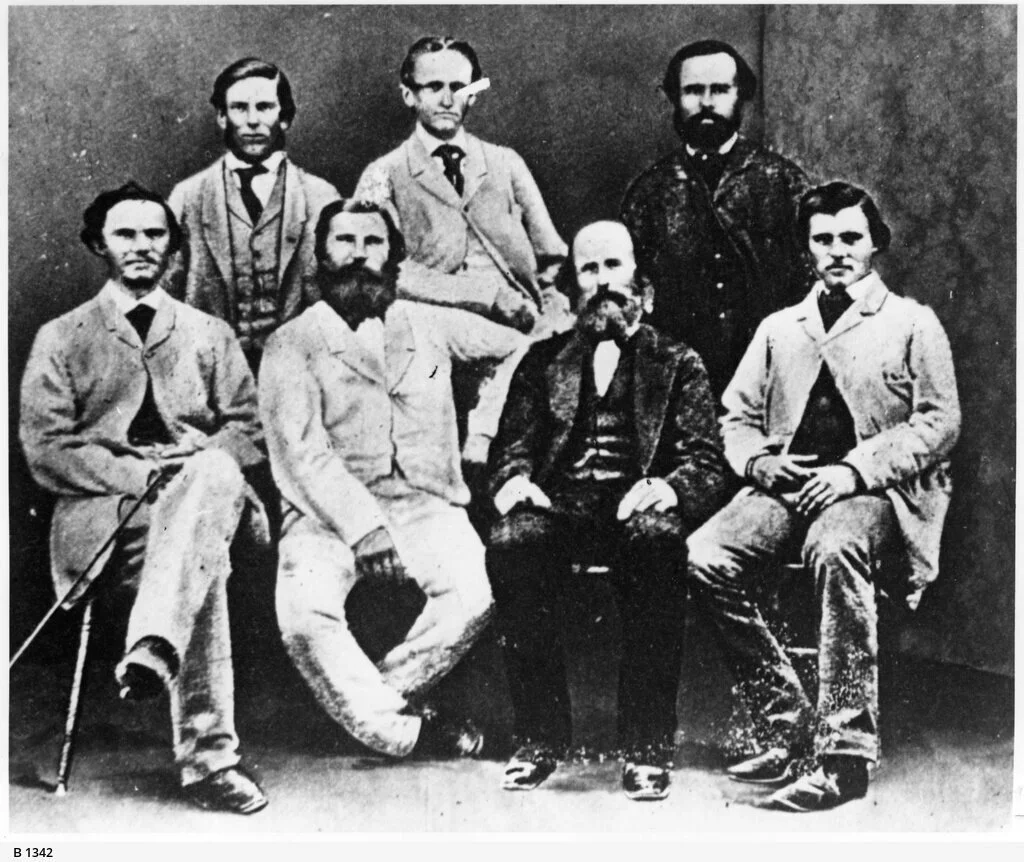
Photo B-1342. State Library of South Australia, J. McDouall Stuart Expedition members [B 1342] • Photograph. Approximately 1862. https://collections.slsa.sa.gov.au/resource/B+1342 Members of Stuart's sixth expedition: Rear - W.P. Auld, J. Billiatt, F. Thring; Front: J. Frew, W. Kekwick, F. Waterhouse, S. King. Absent: J.McD. Stuart, H. Nash, J. McGorrery.